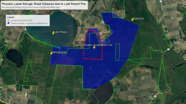
Satellite map of Pocosin Lakes showing all parts of the refuge closed between DeHoag and Middle Roads and the approximate fire boundary in the vicinity of Harvester, J Canal, and Western Roads. For accessibility please call, 252-796-3004.
Publication date
Media Usage Rights/License
Public Domain