
Photo By/Credit
Patrick Donnelly/Intermountain West Joint Venture, USFWSDate Shot/Created
10/12/2023Media Usage Rights/License
Copyrighted, All Rights Reserved - Used by Permission
Image
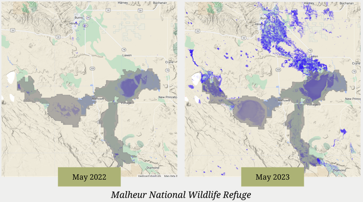
Map visualization showing the surface water levels at Malheur National Wildlife Refuge from May 2022 and May 2023 from the Wetland Evaluation Tool App
Facility
Ecosystem
Wetland