
Photo By/Credit
Dana Allen/FluidState Consulting
Date Shot/Created
11/16/2021Media Usage Rights/License
Copyrighted, All Rights Reserved - Used by Permission
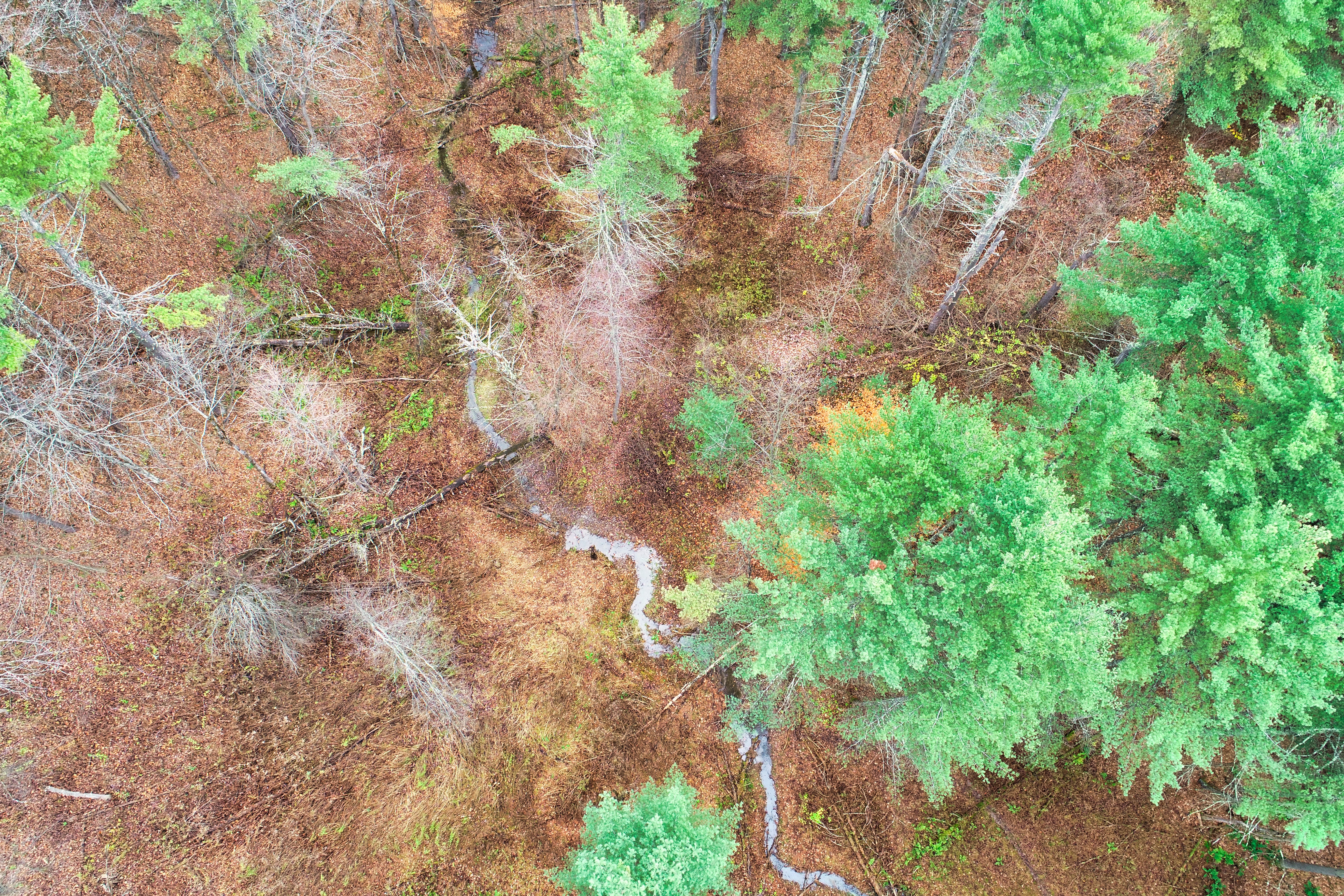
Image
This drone image was taken after a rainstorm approximately 1 month post construction. Crooked Creek runs south to north, or bottom to top. BDAs are present two places along the stretch visible here, in the middle of the photo as well as near the top. One can see that the creek is wider just before these structures, showing that they are effectively slowing water and allowing it to spread above the banks and into the floodplain.