
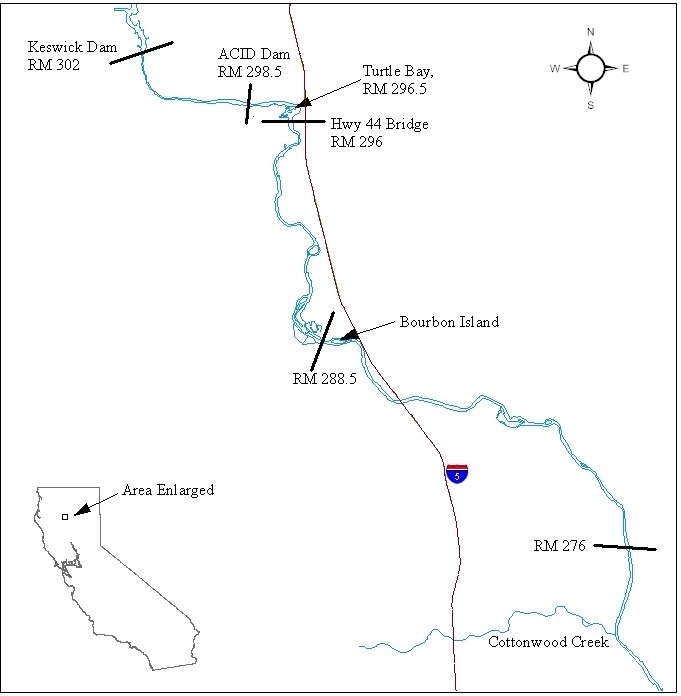
This map shows the area of the Sacramento River surveyed for endangered winter-run Chinook salmon carcasses each year by the Red Bluff Fish and Wildlife Office and the California Department of Fish and Wildlife. The survey is conducted in primary spawning areas, extending from the upstream limit of migration at Keswick Dam downstream to about the confluence of Cottonwood Creek. Different reaches of the river are surveyed seven days a week from May through August. Salmon carcasses provide information that is used to estimate the abundance of winter Chinook salmon. Additional information collected includes gender, length, spawning location, and natural or hatchery origin. Tissue samples are collected for genetic analyses.
Type of document
Map
Facility

Program

Species

FWS Focus
Ecosystem