

Increased focus within the Service on biological planning, strategic habitat conservation, and conservation design underscores the need for scientifically sound spatial models to guide conservation. The HAPET Office has developed methodology to use stop-level georeferenced North American Breeding Bird Survey (BBS) data to create spatial models to inform conservation of many bird species.
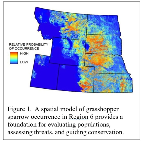
HAPET is currently developing models for grassland birds, which are declining faster and more consistently than any other bird group, and are a priority in Region 6 (Figure 1). This project was a cooperative effort between staff from the HAPET offices, as well as staff from the Prairie Pothole and Rainwater Basin joint ventures.
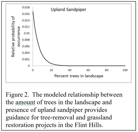
Unlike planning tools that stack data layers and assign scores, these models provide scientifically sound, species-specific guidance at scales that are meaningful to on-the-ground conservation. More important, the models on which the maps are based demonstrate biological relationships and landscape linkages that can be used to guide a variety of conservation actions, including (in the case of grassland birds) land protection, grassland restoration, and tree removal (Figure 2).
Models are available for occurrence and counts, depending on species. The process that HAPET has developed can be applied to many species across the nation in a variety of habitats.


