Visit Us
Know Before You Go
- Late October through early April offer the best times to view waterfowl on the refuge. The forest come alive in spring with the arrival of warblers and other migratory songbirds, while, red fox, wild turkey and white-tailed deer may greet you year-round.
- Mosquitoes and flies can be prevalent during the spring and summer. Be sure to bring bug spray.
- Poison ivy and ticks are found throughout the refuge. Stay on the trails to limit your exposure.
- Restrooms are located at the visitor center and the start of the White Oak trail.
Points of Interest
- Experience the interactive exhibit hall featuring Long Island ecosystem dioramas, Discovery Island touch table and night room.
- Visit the nature store run by the non-profit Friends of Wertheim Refuge.
- Hike almost six miles of trails through Pine Barrens forests and along the State designated Wild & Scenic Carmans River.
- Discover recreational opportunities on all the Long Island National Wildlife Refuges.
- FREE Junior Refuge Manager program (Ages 7 – 12) and Virtual Geocache program (Ages 10 – 16)
Activities
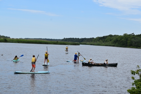
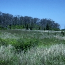
Wertheim offers more than six miles of hiking trails and some of the best paddling on Long Island. Visitors can also enjoy wildlife viewing, nature photography, fishing, environmental education, nature interpretation, and cross-country skiing on the refuge. Waterfowl numbers peak in the winter, while bird watching during the spring and fall migrations allows you to view a variety of birds including raptors, waterfowl and songbirds. The spring bloom decorates the refuge with colorful flowers such as irises, marsh buttercups and violets. Autumn colors are equally splendid! The Visitor Center showcases Long Island ecosystems, wildlife viewing, and other recreational opportunities. An information kiosk, wildlife observation blinds and public restrooms are provided along the trails for your convenience.
Trails
Most wildlife viewing is done from one of two hiking trails. The White Oak Nature Trail is made up of a short loop (1.25 miles) and a long loop (2 miles). The 3.3 mile Black Tupelo trail starts from the visitor center and offers a view of the refuge from the east side of the Carmans River.
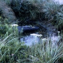
A variety of forest dwelling, waterfowl and wading birds can be seen from both trails. Hot spots include the four Carmans River overlooks. Mammals, reptiles and amphibians can also be seen along the trails and near the water.
Related Documents
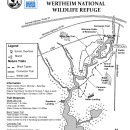
- Wertheim National Wildlife Refuge Hiking Trails (2.8 MB PDF)
- Lower Carmans River Guide (out of print) (1.66 MB PDF)
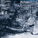
- Long Island National Wildlife Refuge Complex brochure (1.38 MB PDF)
- White Oak Nature Trail Guide (out of print) (1.43 MB PDF)
- Visitor Center Rack Card (329 KB PDF)
Other Facilities in the Complex
The Long Island National Wildlife Refuge Complex consists of seven national wildlife refuges, two refuge sub-units and one wildlife management area wildlife management area
For practical purposes, a wildlife management area is synonymous with a national wildlife refuge or a game preserve. There are nine wildlife management areas and one game preserve in the National Wildlife Refuge System.
Learn more about wildlife management area . Collectively, the ten units are approximately 6,500 acres in size. Each unit is unique and provides a wildlife oasis amongst Long Island’s urban settings essential for the livelihood of migratory birds, threatened and endangered species, fish and other wildlife. The strategic location of Long Island in the Long Island Pine Barrens & along the Atlantic Flyway make it an important nesting, wintering and migratory stop over area for hundreds of species of birds.
Rules and Policies
Everything on the refuge is either a home or food for wildlife, so during your visit help protect wildlife by respecting the following regulations:
- Keep dogs and bikes off of refuges, their presence disturbs wildlife and poses a safety risk to other visitors;
- Use official trails only;
- Take only pictures, leave only footprints;
- Respect refuge boundary signs, closed areas and private property; and
- Pack your garbage out with you.
Locations
By Vehicle
- From the Long Island Expressway (I-495), take Exit 68S to William Floyd Parkway (CR 46S). Make a right onto Montauk Highway (CR 80W), followed by a left onto Smith Road. Follow Smith Road for approximately one-quarter mile (crossing over railroad tracks) – the Refuge entrance is on the right.
- From Sunrise Highway (NY 27E), take Exit 58S to William Floyd Parkway (CR 46S). Follow directions as above.
Transit Directions
- The Long Island Rail Road’s Montauk Branch provides daily service from New York City to the Mastic-Shirley station approximately one mile east of the visitor center. From the station, walk south on Surrey Circle (across from the station entrance) to cross William Floyd Parkway at the pedestrian signal. Continue on Surrey Circle until it reconnects with Northern Boulevard and make a left. Turn left on Smith Road (where Northern Boulevard ends) and the refuge entrance will be 0.2 miles on your right. A limited number of bicycles are allowed on each train.
- Suffolk County Transit (SCT) provides bus service on Montauk Highway, located approximately one mile north of the Visitor Center. Riders on the 66 or 68 may walk one mile down Smith Road to the refuge. A limited number of bicycles are allowed on each bus.


