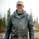
Each winter beginning in 2018, Bill Carter and Sonny Berry of Selawik Refuge have been measuring ice thickness. The refuge has two measurement sites, one for each of the staff members: a lake near Kotzebue (Bill) and the Selawik River just above the village (Sonny). The measurements are collected monthly and submitted to the National Weather Service's Alaska-Pacific River Forecast Center (APRFC). Ice thickness measurements are used by the APRFC to make predictions about breakup and flooding potential in the spring.
We had noticed there were no measurements from northwest Alaska and decided to contribute. The sites need to be in freshwater locations, so that’s why we selected the ones we did. Cooperating with APRFC also means our data can feed into a larger database and be publicly accessible.
An interactive ice thickness map which includes our data, numbers from across the state, and historic data is online at www.weather.gov/aprfc/IceThickness.
If you live in the Northwest Arctic Borough and would like to take ice measurements in your village, contact Bill Carter at our office to learn more about the sampling process.