Photo By/Credit
Eric Dunton/USFWS
Date Shot/Created
02/06/2023Media Usage Rights/License
Public Domain
Image
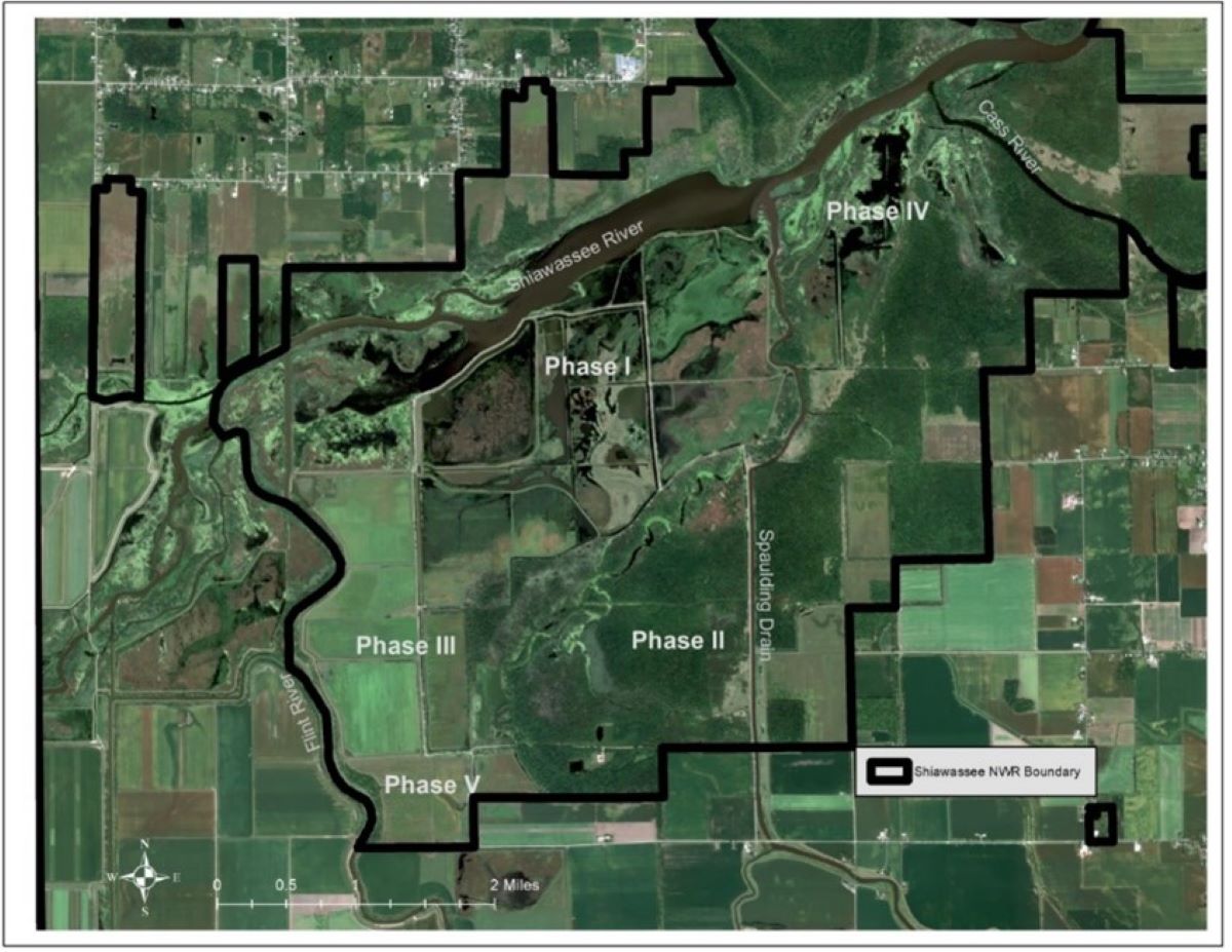
An August 2021 satellite image of Shiawassee Refuge shows the conversion of farmlands to wetlands and a reconnection floodplain.
Ecosystem
Wetland