Paint Rock, Alabama – In the northeast corner of Alabama, a river runs largely hidden from the outside world. Her headwaters begin in the limestone springs and hardwood forests of Tennessee. They then riffle across the Alabama line with an amazing abundance of fish, mussels and snails. Finally, before reaching the bossy Tennessee River, the little river winds through canebrake, cow pasture and cotton field.
The Paint Rock River, just about everybody agrees, is an aquatic gem worthy of protection and conservation. And, for 25 years, in quiet, yet resolute fashion, a variety of federal, state, and nonprofit agencies, as well as local landowners, has worked tirelessly to restore the river to its natural state.
Now, as development edges closer to the Paint Rock, and a changing climate portends trouble for its wealth of threatened and endangered species, the move to create one of the nation’s newest national wildlife refuges gains steam. The Biden administration’s America the Beautiful plan, with the goal of conserving at least 30 percent of the nation’s lands and waters by 2030, further fuels efforts to create the refuge in Tennessee.
Creating a wildlife refuge is no small matter. Of the nation’s 568 refuges, only four have opened in the last five years. The Green River National Wildlife Refuge, established in Kentucky in 2019, is the country’s latest. A Paint Rock River refuge was authorized, or approved, in 2013. But it awaits its first plot of land before it’s considered a real, or “established,” refuge.
David Viker, the regional refuge chief for the U.S. Fish and Wildlife Service (Service) in the Southeast, says Paint Rock will only come to fruition with public buy-in.
“It’s as beautiful as any piece of land we currently have in the refuge system,” Viker says. “It is one of the more significant, relatively pristine, and relatively intact large tracts of land in the southern Appalachian Mountains that’s not already in public ownership, like a national forest or a national park.”
A ‘gem’
A wildlife refuge, like a river, doesn’t exist in a vacuum. Each is dependent upon, and intricately impacted by, its ecological neighbors. A future Paint Rock River refuge, for example, can’t thrive if its headwaters are compromised by erosion, pollution or development.
That’s why Rob Hurt turned off the two-lane blacktop near the Tennessee line and onto recently flooded private land that runs alongside Larkin Fork, a tributary of the Paint Rock. Hurt, a fish and wildlife biologist and the coordinator for the Service’s Partners for Fish and Wildlife Program in Alabama, was checking on the restoration of 300 feet of washed-away streambank. Increasingly heavy deluges of rainwater – a devastating hallmark of climate change climate change
Climate change includes both global warming driven by human-induced emissions of greenhouse gases and the resulting large-scale shifts in weather patterns. Though there have been previous periods of climatic change, since the mid-20th century humans have had an unprecedented impact on Earth's climate system and caused change on a global scale.
Learn more about climate change in Alabama and Tennessee – had destroyed the streambank and sent the Larkin up to the roadway. Prime aquatic habitat for a slew of federally threatened or endangered species had possibly washed downstream.
Rob Hurt, a fish and wildlife biologist with USFWS, checks on a Paint Rock streambank restoration project. Credit: Dan Chapman, USFWS.
“The whole idea is to redirect the flow, the energy, and the velocity of the stream because that’s what’s causing the erosion to the bank,” Hurt says. “The work here benefits other stretches of the watershed. Water flows downhill, after all. So, if you don’t fix things here, you’ll probably have problems downstream.”
The Service, along with The Nature Conservancy (TNC) in Alabama, the Tennessee Valley Authority and Bates Bauer, the landowner, hired a contractor with an excavator to build a floodplain “bench” to slow the clear creek’s flow. Rip-rap, blankets of coconut fiber, and the root balls of large trees were deployed to bolster, and protect, the streambank from further erosion. A slew of smaller rocks was placed in the streambed to further slow the water’s speed and create aerated habitat for fish and mussels.
“As long as it holds up, I think it’ll be good to go,” says Bauer, who camps and cools off by the creek in the summer. “It’ll all grow back up. We’ll plant some black willows and some oaks and let it come back to nature.”
Biodiversity across the Paint Rock watershed is unparalleled. The valley’s streams emanate from the limestone springs of the Cumberland Plateau, at the bottom of the Appalachian chain of mountains. More than 90 percent of the region is forested, mostly with tall, second-growth hardwoods. It also contains the nation’s highest concentration of caves, springs and sinkholes. The awe-inspiring Walls of Jericho, where the Paint Rock cascades through 200-foot limestone walls and down through the gorge, sits along the Alabama-Tennessee line. The bowl-shaped canyon can only be reached after hiking downhill for three miles.
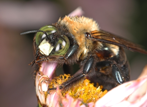
The caves that Swiss-cheese the watershed are home to all manner of threatened and endangered species, including gray bats, Indiana bats, Tennessee cave salamanders and Alabama cave shrimp. But it’s the water that truly distinguishes the region. “Streams within the Paint Rock River watershed” – the Larkin Fork, Estill Fork, and Hurricane Creek – “are home to some of the most biologically significant resources in the United States,” according to the Service. That includes 100 species of fish – like the exceedingly rare and endangered palezone shiner – and 50-plus different freshwater mussels. The pale lilliput and Alabama lampshell mussels are found nowhere else in the world.
The Paint Rock’s deciduous forests also provide habitat for migratory songbirds, including the cerulean warbler whose numbers have plummeted 70 percent over the last 50 years. And the fields, forests, and limestone beds support federally threatened plants – American Hart’s-tongue fern, Price’s potato-bean, white fringeless orchid – and the endangered Morefield’s leather-flower.
“The Paint Rock River, from an aquatics standpoint, is a gem nationally,” says Paul Johnson, who runs the Alabama Aquatic Biodiversity Center and has been studying mussels in the watershed for 20 years. “And it has really diverse terrestrial, snail and fauna species all because of the geology associated with the Cumberland plateau.”
‘Biodiversity hotspot’
Years of logging and farming took their toll on the river as layers of silt suffocated mussel beds. Matters weren’t helped more than a half century ago when the U.S. Army Corps of Engineers undertook a “channel improvement project,” straightening sections of the river to prevent the flooding of cotton, corn and hay fields in the run-up to the Tennessee River. Large tracts have been subdivided to attract second-home buyers (with their septic tanks) from Huntsville, Chattanooga and Atlanta. Climate change – droughts and flooding – impact the river water’s quality and quantity.
A decade ago, the Service unveiled a land protection plan and an environmental study needed to create a Paint River wildlife refuge. It proposed acquiring up to 25,120 acres in Tennessee either by buying land outright from willing sellers, establishing conservation easements, or accepting donations from nonprofit agencies like TNC, The Conservation Fund or the Open Space Institute. The cost: between $36 and $48 million.
In 2013, the Service debriefed members of the Tennessee Wildlife Resources Agency, the Tennessee Department of Environment and Conservation, and local, state and congressional officials. Three public meetings were also held to gauge public opinion. Most people supported the proposal. “Local landowners, in particular, would appreciate it,” says Bauer, who owns a convenience store in nearby Huntland, Tennessee. “It’d be good for hunting and there’d be land that people from outside the area could visit.”
A refuge, though, remains elusive. Viker, the refuge chief, says years of bare-bones budgets have crimped the Service’s ability to buy land and hire people to manage it. Opposition to federal ownership of land, too, sours some elected officials on new refuges, particularly in the South.
“The current administration (in Washington) is supportive of priority-land acquisitions,” Viker says, “but we’re waiting on some base budget increases and some focused land-acquisition dollars, both of which look hopeful in the next year or two.”
The Biden administration’s push to conserve and restore 30 percent of the nation’s land and waters by 2030 bolsters the creation of a Paint Rock refuge. So too do White House efforts to reduce damages wrought by a warming world by creating climate corridors of protected and connected lands so animals can migrate from one region to the next.
“Paint Rock would be perfect for that,” Viker says. “It’s both a biodiversity hotspot and a large, relatively intact ecosystem that connects to the larger landscape. So, it’s a site-specific jewel, as well as a key link in a conservation chain.”
‘Not a quick fix’
Large chunks of land in Tennessee and Alabama – wildlife management areas, nonprofit tracts, conservation easements, privately conserved lands – have already been protected across the Paint Rock watershed. The trick is to stitch together the patchwork assemblage into a seamless mosaic of conserved lands. Meanwhile, the Service, U.S. Department of Agriculture, various nonprofits, and the states have undertaken 50 or so water quality projects across the watershed to help the species that make the region so unique. Streambank restorations. Fish-barrier removals. Cattle-exclusion fences. Floodplain re-forestings. Fish and mussel reintroductions.
“The numbers, and the diversity of mussels, as well as the complexity of mussel beds, that have come back over the last 15, 20 years has been quite remarkable,” says Johnson, the Alabama malacologist.
The Nature Conservancy’s fingerprints are found on virtually every major Paint Rock project. TNC, with financial help from the Service and others, cobbled together more than 20,000 acres – including the Walls of Jericho – in Tennessee and Alabama that were then conserved. The nonprofit owns the 4,000-acre Sharp Bingham Mountain Preserve (home to the Paint Rock Forest Research Center) and the Roy B. Whitaker Preserve on down the valley. It also deployed a biologist to work exclusively in the watershed for a decade.
Still, only 10 percent of the Paint Rock watershed is protected.
To which Rob Hurt says, “Patience.” The Service biologist crosses the still-new bridge over Estill Fork in his F-150. The bridge replaced a low-grade ford that frequently flooded, blocked fish from migrating upstream, and muddied the mussel-loving substrate. It was paid for by the Service, TNC, and Jackson County. And it works.
“The water is a lot clearer than it used to be,” Hurt says with pride. “The whole river is. But it’s going to take decades to clean up the entire Paint Rock. It’s not a quick fix. But we’re in it for the long haul.”