

Trails

The Mountain View Trail is named for the view of Mt Hood that can be seen on a clear day. It allows you to look out east over the Refuge from the trail that sits high on top of this west levee. The trail also serves as a service road, used only occasionally for maintenance purposes.
The main access to this trail is from the parking lot. Head up the trail just past the restrooms to the top of the levee. The trail continues straight ahead to a viewpoint where you’ll find two stone benches and breathtaking views of the floodplain below. Beyond the viewpoint the trail will continue for about a mile, before intersecting the Refuge River Trail.
Trail name: Mt. View Trail
- Open season: Year-round
- Access: from the main entrance parking lot, located of SR-14/45th street
- Uses: Pedestrian only. (No dogs, horses or bicycles) Great for wildlife observation and photography
- Length: 1 mile
- Difficulty: Wide, flat trail with incline from parking lot to top of the trail and slight decline where meets Refuge River Trail
- Route type: Point to point as part of a larger trail network
- Surface: Compact gravel
- Average width: 12 feet
- Max slope: 5%
- Benches: 2 stone benches at viewpoint, 2 solid wooden benches with a back rest, a handrail, and open side along trail
Things to consider:
- Because this trail is up you are more exposed to the weather. There are no shaded areas or wind protection on this trail.
- There are no physical markers to designate the sides of the trail
- There are no distance markers or other signage along the trail
- The gate in the parking lot closes automatically. Remember to check the closing time and give yourself plenty of time to return to your car. Visitors locked in the parking lot will need to call the police non-emergency line at 311.

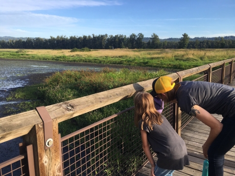
The Refuge River Trail is the only multi-use trail allowing the unique opportunity to experience the Refuge with a bicycle, horse, or leashed dog. The trail can be accessed from the western entrance of the Refuge near Index Street (see William Clark Park), or by the pedestrian only Mt. View Trail. From Index Street it meets up with the Mt. View Trail after about a mile and continues east for 2.5 more. This trail parallels the Columbia River and then meanders further into the Refuge. Two large foot bridges and a viewpoint overlooking the river allows you different ways to connect and view the Refuge.
Trail name: Refuge River Trail
- Open season: Year-round
- Access: from the western entrance of the Refuge near Index Street (see William Clark Park), or by the pedestrian only Mt. View Trail
- Uses: Pedestrians, bicycles, jogging, horseback riding, and leashed dogs. Great for scenic views and exercise
- Length: 3 miles
- Difficulty: Wide, flat trail with minimal slope changes, with two bridge crossings
- Route Type: Point to point as part of a larger trail network.
- Surface: Compact gravel, wooden slated bridges
- Average width: 10 feet
- Max slope: 5%
- Benches: one wooden bench with backrest, handrail and open seating west of the trail intersection with the Mt. View Trail, at viewpoint, and first bridge
Things to consider:
- This trail has heavy use on sunny days, especially in the summer. Visitors share this trail with horses, cyclists, and leashed dogs.
- There are no distance markers or other signage along the trail
Along the Wildlife Art Trail you will not find signs to read, but art to discover as you explore. Look for quotes hidden among the stone benches, unique sculptures, and wildlife cut outs to lock your bike to. We hope this art will inspire you to wonder about the nature it represents.
The trail is accessed from theRefuge River Trail and wraps around Redtail lake over two bridges. A small out and back trail heads west off the second bridge to a short dead end looking out over a wetland. The trail connects with the Refuge River trail again at the first of the two bridges.
Trail name: Wildlife Art Trail
- Open season: A section is closed seasonally between artwork "doors" Oct 1 - April 30, with year-round access from Refuge River Trail to bridge 2 (Cottonwood bridge)
- Access: from Refuge River Trail where intersects near Redtail Lake (year-round) and from bridge 2 (Dragonfly bridge) on the Refuge River trail seasonally, May 1 - Sept 30
- Uses: Pedestrian only. (No dogs, horses or bicycles) Great for wildlife observation and photography
- Length: 1 mile
- Difficulty: Flat trail, narrow in some places with two bridge crossings
- Route Type: Point to point as part of a larger trail network
- Surface: Compact gravel
- Average width: 6 feet
- Max slope: 5%
- Benches: At Redtail lake and between the two bridges
Things to consider:
- Dogs, horses and bicycles are not compatible with the wildlife needs on this part of the refuge. Please plan accordingly if you plan to use this part of the trail network. Bicycle racks are available
- There are no distance markers or other signage along the trail