

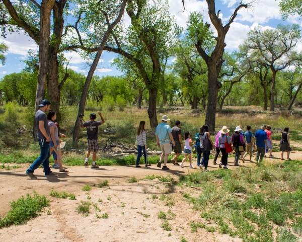
Interpretive Trail
Open Season: Open year-round, best used October - April
Length: 0.20 Miles
Location of trail: Behind Visitor Center
Surface: Gravel
Difficulty: Easy
The interpretive trail loop begins and ends behind the visitor center. Hikers can learn about Sonoran Desert wildlife and plants, watch for birds in the bird blind, and visit the Quitobaquito pupfish pond.
Childs Mountain
Open Season: Open year-round, best used October - April
Length: 4.3 Miles (one way)
Location of trail: Childs Mountain Road (turn west at mile 36.7 on AZ-85), north of Visitor Center.
Surface: Paved
Difficulty: Hard (Steep)
The O’odham name for Childs Mountain is Kavad Mehidag, meaning “Remains of Burnt Shield.” Childs Mountain was once the site of a sprawling military base, complete with barracks, family housing, and a bowling alley. Today, the landscape has largely been renaturalized. Ajo Radar Station perches on top of the mountain–a single reminder of the landscape’s past.
Charlie Bell Pass
Open Season: Open year-round, best used October - April
Length: 1.5 miles (one way)
Location of trail: End of Charlie Bell Road.
Surface: Gravel
Difficulty: Moderate (Steep)
Charlie Bell Pass offers the easiest east-west passage through the rugged Growler Mountains. A natural seep known as Charlie Bell Well has provided water here for hundreds – if not thousands – of years. More than 2,700 petroglyphs have been documented within 200 feet of the well.
Copper Canyon
Open Season: Open year-round, best used October - April
Length: 1.2 Miles (one way)
Location of trail: Northwest entrance is off Charlie Bell Road, Southeast entrance to trail is at the end of Bureau of Land Management road 8113 G.
Surface: Gravel
Difficulty: Moderate
This road is closed to public vehicle use making it is a great path to hike! If you enjoy observing the wildlife in the area, keep an eye out for the many birds that can be seen along the wash next to the road. As you continue along the road, you will see that it exits the refuge onto BLM road 8113G.
San Antonio Mine
Open Season: Open year-round, best used October - April
Length: 1.2 Miles (one way)
Location of trail: Trail can be access by Bureau of Land Management road 8113B
Surface: Gravel
Difficulty: Moderate
Created before the establishment of the refuge in 1939, San Antonio Mine was used to collect silica flux, feldspar, and scrap mica. To this day, visitors of the mine can still behold rocky hills that glitter with mineral deposits.