
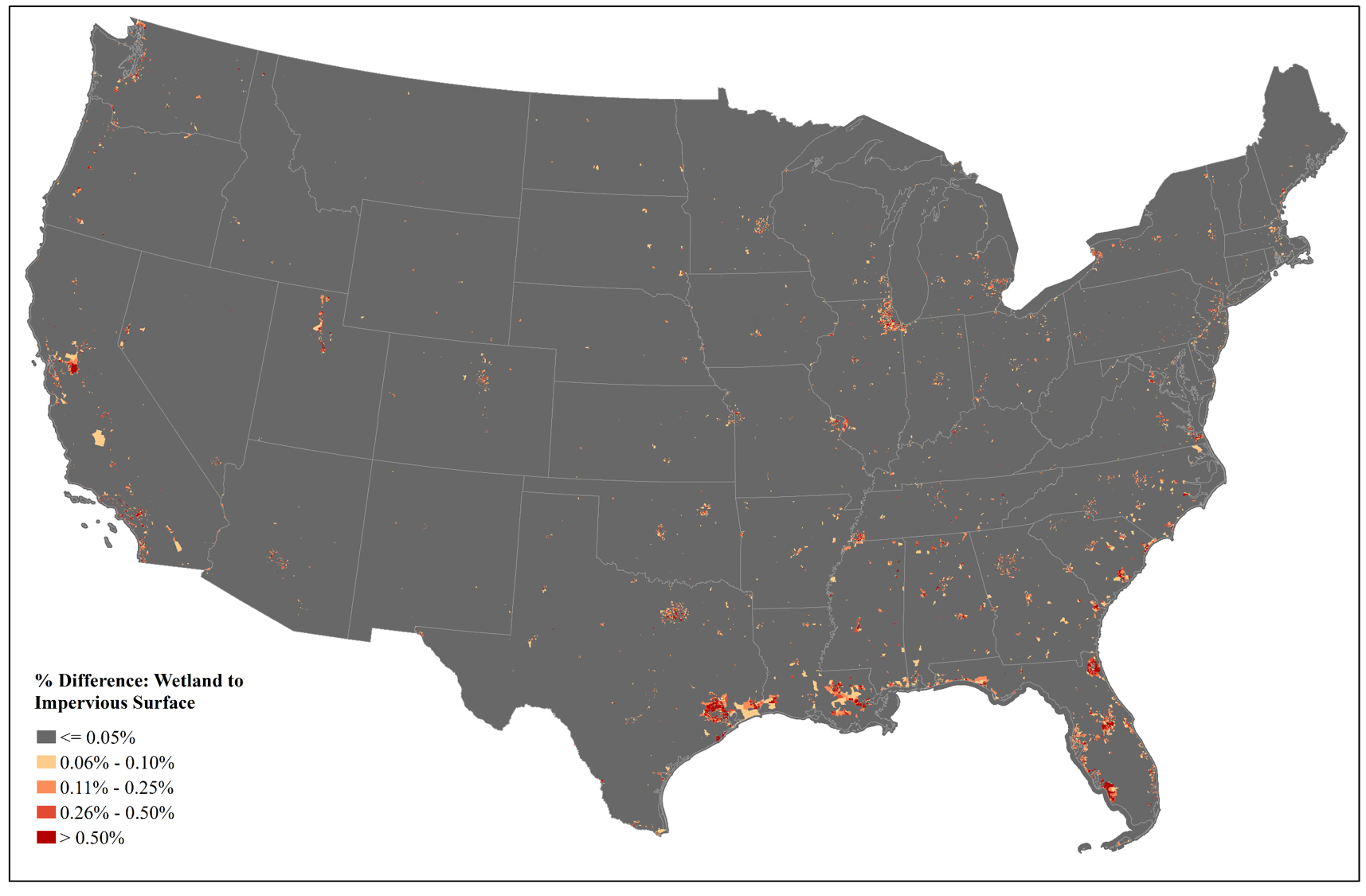
Photo By/Credit
University of Maryland in coordination with the USFWS
Date Shot/Created
05/27/2022Media Usage Rights/License
Public Domain
Image
Wetland to Impervious Surface Difference Product for census tracts in the Contiguous US. Census tracts with ≤0.05% of wetland to impervious surface difference, calculated by area, are displayed in gray, while those that have greater than half a percent difference are displayed in dark red. Patterns are largely controlled by the age of National Wetlands Inventory (NWI) data and development trends. Thus areas that exhibit greater difference (i.e., change) may have older NWI data, more development, or both. These areas are commonly found near cities. Note that although there are concentrated areas of difference, likely change due to impervious increase, the vast majority of the United States has not experienced this level of change since NWI data production and therefore has NWI data that better represent current land cover. Geographies with the greatest levels of difference could be prioritized for NWI updates