

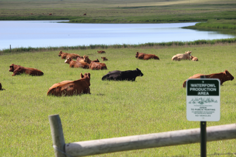
We are seeking grazing applicants on several of our waterfowl production areas for 2026.
Applications must be postmarked, emailed, or received in the office by on March 10, 2026. Applications will be opened on March 12th. See regulations and maps for full details.
Announcement, Regulations, and Application
Grazing Unit Maps
Applications can be mailed or dropped off at: Huron Wetland Management District, 20721 392nd Ave, Wolsey, SD 57384
Or emailed to: Fred_Oslund@fws.gov
(if emailed you will receive a confirmation that your application is received)
Visit Us
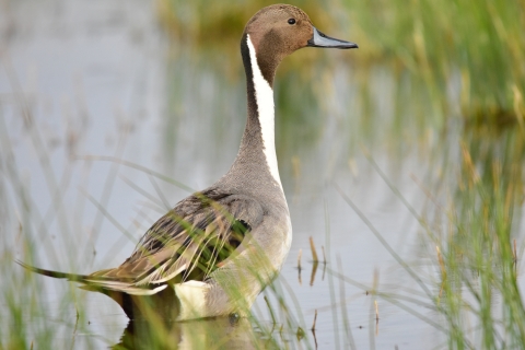
The Huron Wetland Management District manages 17,683 acres of fee title waterfowl production areas and numerous conservation easements in the world renowned prairie pothole region. The prairie pothole region is named for the millions of depressional wetlands dispersed throughout the landscape. Waterfowl rely on its many wetlands during spring and fall migration for feeding and resting, as well as raising their young during the summer months.
Location and Contact Information
About Us

The Huron Wetland Management District was established to protect and enhance wetlands and grasslands. District staff are responsible for managing scattered tracts of lands called Waterfowl Production Areas for waterfowl, shorebirds, and other species of wildlife. Waterfowl Production Areas are open to hunting, fishing, trapping, wildlife photography, wildlife observation, environmental education, and interpretation. The Huron Wetland Management District has an active easement acquisition program that partners with willing landowners to preserve important wildlife habitats on private lands.


