

Visit Us
Wetland management districts offer us all a chance to unplug from the stresses of daily life and reconnect with our natural surroundings. Visitors to waterfowl production areas will find numerous ways to engage with nature. The prairies and wetlands of waterfowl production areas are teeming with life, and often a short hike through the tall grass to the wetland edge will expose numerous species of plants, insects and animals to careful observers. Even in the cold winter months, a short hike, ski or snowshoe trek will reveal numerous tracks, indicating how persistent wildlife can be.
Those wanting to engage with nature through hunting, foraging or trapping will also find numerous opportunities on waterfowl production areas. Plentiful wetlands of varying size and depth provide habitat for fish, waterfowl, beavers, muskrat and more. The surrounding grasslands, sometimes with grass over seven feet tall, provide nesting habitat for waterfowl and ring-necked pheasants, which can be pursued in the fall. Adventurous eaters may forage wild edibles, including nuts, berries and mushrooms for personal use among the various habitats found on waterfowl production areas.
Rare and disappearing habitats are found on waterfowl production areas as well, and each acre provides unique and necessary conditions for various specialist plants and animals. Oak savannas and native prairie remnants are windows into the past, and several plant species are restricted to these habitats, while birds such as the red-headed woodpecker rely on the mast produced within oak savannas.
Driving Directions
To visit the district headquarters and Bloomington Education and Visitor Center
3815 American Blvd. East
Bloomington, MN 55425
Phone: 952-854-5900
TTY: 1-800-877-8339
From Interstate 494: From Interstate 494, exit at 34th Avenue and head south. At the stop light on American Blvd. East, proceed east for 1/4 mile around a small bend in the road to arrive at the entrance and parking lot. Visitors can also take the Metro Transit Blue Line train south to the American Blvd. stop, and cross 34th Avenue to the east. Follow the sidewalk 1/4 mile around the bend and up a small rise to find the entrance and parking lot.
To visit the district contact station and Rapids Lake Education and Visitor Center
15865 Rapids Lake Road (formerly Carver Highlands Drive)
Carver, MN 55315
Phone: 952-361-4500
TTY: 1-800-877-8339
Driving directions from Highway 169: From Highway 169 in Jordan, proceed north 3.5 miles on County Road 9 across the Minnesota River (where it becomes County Road 11) to Carver Highlands Drive and turn right. Continue onto Rapids Lake Road. Follow to the visitor center.
Driving directions from Highway 212: From Highway 212, exit on Jonathan Carver Parkway (County Road 11) and turn south. Proceed 2.5 miles, continuing on County Road 11 by turning left. Proceed 1.9 miles and turn left on Carver Highlands Drive. Continue onto Rapids Lake Road. Follow to the visitor center.
Fees
There is no charge to visit.
Restrooms
Restrooms are available inside the Bloomington and Rapids Lake Education and Visitor Centers during open hours. There is a comfort station accessible seasonally from outside the Rapids Lake Education and Visitor Center.
Points of Interest
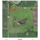
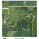
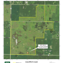
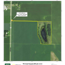
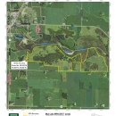
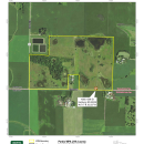
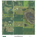
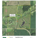
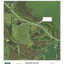
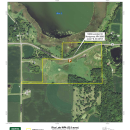
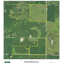
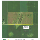
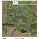
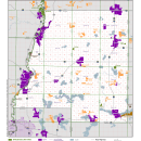
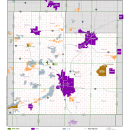
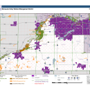
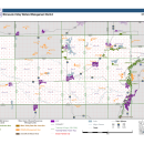
There are 33 tracts of land called waterfowl production areas on the district that offer great opportunities for wildlife dependent recreation, viewing and observation in Blue Earth, Dakota, Scott, Le Sueur, Rice, Sibley, Carver, Steele and Waseca counties.
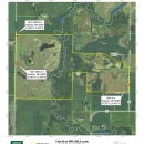
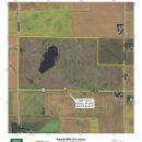
Lincoln, Cobb River and Watonwan waterfowl production areas, in Blue Earth County, have been recently restored and provide prairie and wetland habitat for shorebirds, waterfowl, deer and grassland songbirds.
Cobb River Waterfowl Production Area is a diverse unit containing prairie, wetland and floodplain forest habitat. This unit is a prime example of the transition zone between northern tallgrass prairie and the forested floodplains of the Cobb River.
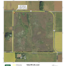
Watonwan Waterfowl Production Area contains remnant oak savannas and designated parking areas on this unit offer a beautiful hilltop view of the wetlands and surrounding prairie.
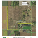
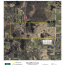
Closer to the metro, Tiger Lake Waterfowl Production Area, near Norwood Young America, provides an easy opportunity to escape the city and experience a young grassland and wetland restoration.
Soberg Waterfowl Production Area, the first waterfowl production area waterfowl production area
Waterfowl production areas are small natural wetlands and grasslands within the National Wildlife Refuge System that provide breeding, resting and nesting habitat for millions of waterfowl, shorebirds, grassland birds and other wildlife. Virtually all waterfowl production areas are in the Prairie Pothole Region states of Iowa, Minnesota, Montana, North Dakota and South Dakota.
Learn more about waterfowl production area in the district, is also located a short drive south of the Twin Cities Metro Area, in Lakeville, where numerous wetlands and plentiful wildlife can be found throughout the rolling topography of this waterfowl production area.
What To Do
If you have 15 minutes
- Visit the Rapids Lake Education and Visitor Center
- View a vast array of native flowers blooming in the prairie in summer
- Take in views of the frozen river in winter or changing leaves in the fall
If you have one hour
- Visit a waterfowl production area near you - hike the prairie, look for birds or forage for mushrooms
- Create a life list of birds to see. Head out for just an hour to see how many you can check off your list today!
If you have half a day or more
- Visit a waterfowl production area (or two!) near you – hunt, trap, birdwatch, forage for wild edibles, hike, cross-country ski or snowshoe
- Create a scavenger hunt for the kids and head out for a fun adventure for the family or a group of friends
Know Before You Go
Be prepared for your visit. We recommend wearing a sturdy pair of boots as you may encounter flooding, wet or muddy areas, thorny vegetation and rough ground during your visit. There are generally no maintained trails beyond the parking lots of waterfowl production areas, so dress appropriately. During warm weather, wear bug spray and sunscreen and bring drinking water. Waterfowl production areas are open to fishing, hunting and trapping per Minnesota state regulations. We recommend wearing blaze orange during hunting seasons.
Visitor Tips
Waterfowl production areas are least busy on weekdays and outside of state hunting seasons. Lands farther from the metropolitan area also see significantly fewer visitors. Wildlife sightings are common throughout the day, but mornings and evenings are usually the best time for observing wildlife.
April - May is a great time for a hike and a special time to see migrating songbirds just before the leaves pop out. You might even find morel mushrooms as the weather warms.
June - August is perfect for learning new wildflowers and identifying native plants in our prairies.
September - November is cooler and provides enjoyable hikes with fewer biting insects.
December - March provides snow for a snowshoe hike and lots of tracks from winter loving mammals. See if you can decipher what the wildlife are up to by the tracks they leave.
Activities
Many opportunities for enjoying nature can be found on Minnesota Valley Wetland Management District. Non-consumptive activities are highly recommended (e.g. wildlife viewing, photography, hiking, and education, etc.), and traditional wildlife dependent recreation (e.g. hunting, trapping, and foraging) is available per state and federal regulations as well.
Trails
Rapids Lake Trail
Open season: Open year round - Walking and biking spring to fall, snowshoeing and cross-country skiing in winter. This trail is open to biking; floods seasonally.
Length: 2.7 miles, one-way
Location of trail: Rapids Lake Unit, Carver
Surface: Natural surface
Difficulty: Easy
Information: This trail begins at the Rapids Lake Education and Visitor Center. It follows river bottom forest and marsh for much of its length. At 0.6 miles, you will pass a pond at the base of the ridge. River rapids can be viewed (at low river levels) 1 mile from the visitor center. The north end connects to the Carver Creek Loop Trail. This trail is mostly flat and floods seasonally. Look for tracks along the trail after wet periods. Northern / middle portions of this trail are typically inaccessible due to flooding and flood impacts.
Forest Loop Trail
Open season: Open year round - Walking and biking spring to fall, snow shoeing and cross-country skiing in winter. This trail is open to biking.
Length: 0.6 miles, loop
Location of trail: Rapids Lake Unit, Carver
Surface: Natural surface
Difficulty: Easy
Information: Leaving from the asphalt trail below the Rapids Lake Education and Visitor Center, this mostly level trail courses through oak and hickory forest, with a brief view of a slough connecting to Long Lake. View wood ducks in the slough and listen for frogs calling.
North Hunter Lot Trail
Open season: Open year round - Walking spring to fall, snowshoeing, cross-country skiing and fat tire biking in the winter. This trail is open to biking.
Length: 1 mile, one-way
Location of trail: Rapids Lake Unit, Carver
Surface: Natural surface
Difficulty: Easy
Information: This trail is a mowed service road running from the parking lot on County Road 11 (Jonathan Carver Parkway) to the northeast, where it ends at the refuge boundary. View native wildflowers, bur oaks, woodpeckers and prairie skink in this restored oak savanna. Please note: wearing blaze orange highly recommended during hunting seasons.
Carver Creek Loop Trail
Open season: Open year round - Walking and biking spring to fall, snow shoeing and cross-country skiing in winter. This trail is open to biking.
Length: 1.6 miles, loop
Location of trail: Rapids Lake Unit, Carver
Surface: Natural surface
Difficulty: Easy
Information: This trail system has three entry points: Bluff Park, Ash Street (downtown Carver), and the Rapids Lake Trail. Connect to Bluff Park from the west (Bluff Park Spur, 0.3 miles) or Ash Street from the north 0.2 miles. Portions of this trail experience seasonal flooding.
Related Documents
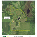
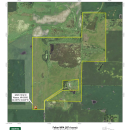
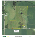
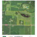
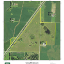
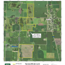
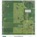
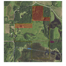
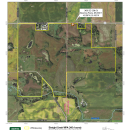
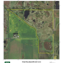
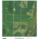
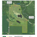
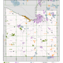
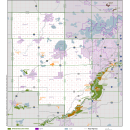
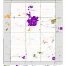
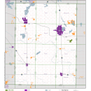
See below for a list of detailed maps of the WPAs and overviews of WPAs by county.


Other Facilities in the Complex
Minnesota Valley Wetland Management District is part of Minnesota Valley National Wildlife Refuge, headquartered at the Bloomington Education and Visitor Center.
The wildlife refuge is part of a corridor of land and water stretching nearly 70 miles along the Minnesota River from Bloomington to Henderson, Minnesota. Comprised of more than 14,000 acres, the refuge spans across both rural and urban communities, and offers a variety of free outdoor recreational experiences for individuals and families.
Together, the refuge and wetland management district wetland management district
A wetland management district is a U.S. Fish and Wildlife Service office that manages waterfowl production areas in one or more counties. Waterfowl production areas are small natural wetlands and grasslands that provide breeding, resting and nesting habitat for waterfowl, shorebirds, grassland birds and other wildlife. The Fish and Wildlife Service acquires waterfowl production areas under the authority of the Migratory Bird Hunting and Conservation Stamp Act, primarily using funds from the sale of Federal Duck Stamps. The Refuge System’s 38 wetland management districts comprise thousands of waterfowl production areas – almost all in the Prairie Pothole Region of the Northern Great Plains.
Learn more about wetland management district conserve 25,000 acres of land for wildlife habitat and recreation around the Twin Cities metro area.

Rules and Policies
Welcome to your wetland management district wetland management district
A wetland management district is a U.S. Fish and Wildlife Service office that manages waterfowl production areas in one or more counties. Waterfowl production areas are small natural wetlands and grasslands that provide breeding, resting and nesting habitat for waterfowl, shorebirds, grassland birds and other wildlife. The Fish and Wildlife Service acquires waterfowl production areas under the authority of the Migratory Bird Hunting and Conservation Stamp Act, primarily using funds from the sale of Federal Duck Stamps. The Refuge System’s 38 wetland management districts comprise thousands of waterfowl production areas – almost all in the Prairie Pothole Region of the Northern Great Plains.
Learn more about wetland management district . District lands are open every day for you to discover new places to hunt, fish, take pictures, watch wildlife, pick wild edibles (for personal use), trap, hike, cross-country ski and snowshoe.
Hunting, fishing and trapping seasons generally follow state seasons and regulations. Please consult the wetland management district headquarters at 952-854-5900 if you have questions. We may post additional site-specific regulations.
To ensure your safety and protect wildlife and habitat, please be aware of these regulations.
General Restrictions
- Access to district lands are open from 1/2 hour before sunrise until 1/2 hour after sunset unless otherwise posted
- Camping, open fires and overnight parking are prohibited
- Pets must remain on a 6-foot or shorter leash at all times and off-leash training of any kind is prohibited
- Drones may not launched, landed or flown over the district, including personal or commercial use, without a special use permit
- Do not enter areas signed as closed. For access information related to hunting, visit our hunting information web page.
- Hunting is permitted in season, and refuge regulations supersede state regulations.
We prohibit
- Target shooting
- Training pets and allowing pets off leash
- All types of motorized vehicles on all refuge land (including on frozen bodies of water) except on designated parking areas, access roads and public roads
- Drones (UAVs) taking off, landing and/or flying on or over district lands
- Launching, landing or disturbing of wildlife by aircraft (includes drones) on the district. This includes for recreational or commercial purposes.
- The use of a spotlight, headlight or other artificial light to spot, locate or take any wild animal
Additional Information
Special-use permits may be issued for compatible secondary uses upon approval of the district manager. Contact the district headquarters for application information at 952-854-5900 or by email MinnesotaValley@fws.gov.
Locations
**GPS USERS**
Type the above address into your GPS. If you type in "Minnesota Valley National Wildlife Refuge", Google, Bing, and Mapquest will bring you to the refuge's Louisville Swamp Unit in Shakopee, MN.
From Interstate 494, exit 34th Avenue and head south. Proceed east on American Blvd East for 1/4 mile to the entrance on the right.
Metro Transit: Hiawatha Light Rail - Depart at the American Blvd/34th Avenue Station. Proceed east on American Blvd East for 1/4 mile to the entrance on the right.
**GPS USERS**
Type the center address in to your GPS. If you type in "Minnesota Valley National Wildlife Refuge", Google, Bing, and Mapquest will bring you to the refuge's Louisville Swamp Unit in Shakopee, MN.
Driving Directions from Hwy 169:
From Hwy 169 in Jordan, proceed north 3.5 miles on County Road 9 across the Minnesota River (where it becomes County Road 11) to Carver Highlands Drive and turn right. Continue onto Rapids Lake Road. Follow to the visitor center.
Driving Directions from Hwy 212:
From Highway 212, exit on Jonathan Carver Parkway (County Road 11) and turn south. Proceed 2.5 miles, continuing on County Road 11 by turning left. Proceed 1.9 miles and turn left on Carver Highlands Drive. Continue onto Rapids Lake Road. Follow to the visitor center.