Written By

After a two year hiatus, we were once again able to conduct the Waterfowl Breeding Population and Habitat Survey. It was an interesting year, mainly in that the conditions on the ground have changed dramatically just since March!
Overall, the Dakotas look good for waterfowl production, particularly north of Huron, South Dakota. Some April snow storms, April and May rain, and good snowfall in eastern North Dakota over the winter, all combined to vastly improve looming conditions at the end of March. While the improved wetland conditions are welcomed, many of the seasonal wetlands have been substantially degraded over the past several years of drought and will not add much to the quality of the habitat this year from a waterfowl production standpoint. On the upside, it was a welcome sight to see full or near full permanent and semi- permanent wetlands across the landscape, particularly north of Huron SD. Overall, I would say that the prairie pothole region in the Dakotas is good. However, south of Huron, SD and particularly south of I-90 and east of Mitchell in areas around Madison, SD are still particularly dry.
This year presented many challenges both prior to and during the survey. We were short a pilot this year and that resulted in having to fly some additional transects that I do not normally fly. That, in and of itself isn’t a big deal, but that was exasperated by numerous logistical challenges that I also do not normally encounter. I now had to manage to get through the survey without any additional downtime for an inspection as well as keep two ground crews progressing simultaneously. After many planning calls prior to the survey developing a plan for this, we were ready to go. All we needed was for Mother Nature to cooperate and it would work perfectly, right?! Famous last words!
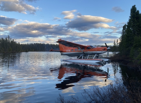
By April 30th, everybody was in place and ready to go to begin the survey in the area of South Dakota west of the Missouri River. My aerial observer, USFWS biologist Dave Fronczak arrived in Spearfish, South Dakota from Minneapolis. The ground crew, consisting of USFWS biologist Dan Collins and USFWS biologist Tom Cooper, were also in position in Pierre, South Dakota. Dan came in from Albuquerque, New Mexico where he is the Migratory Game Bird Biologist for the USFWS Southwest Region and Tom arrived from Minneapolis, Minnesota from where he is currently transitioning to his position as the Central Flyway Representative.
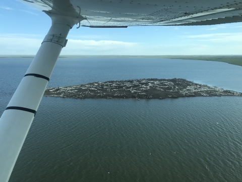
The ground crew is a critical element of the Waterfowl Breeding Population and Habitat Survey. The transects the aircrew fly are divided into numerous 18-mile segments. A certain number of these segments are also surveyed by ground crews. These are known as air-ground segments. The ground crew surveys these segments in a very methodical manner and ground truth what we see from the air. It takes them as long to ground check one 18-mile segment as it does for us to fly several hundred miles of transects each day. The numbers and species that they detect on the ground are then compared to the number and species we detect from the air. Obviously, the ground crew can detect more than the air crew because they are going slower and they walk to each wetland and flush birds that may have been hiding in the reeds that the air crew could not see. From this ground-truthing, a visual correction factor is calculated and applied to all of the segments we fly. In other words, the ground crew is considered the “truth” and their numbers correct, as compared to the less-than-perfect observations we can make form the air due to speed and visibility. It would take a large army to conduct the whole survey from the ground in a timely manner and considering many parts of the survey cannot be reached from the ground, this system of calibrating for the differences between the air and ground has served us well to accurately estimate the number of ducks in the area.

So, with the plan and the crews in place, we were off and flying early on the morning of May 1st. The strategy required us to fly three air-ground segments in one day and one the next day. This would keep the ground crew moving along in South Dakota while the air crews in Montana started working their way to survey segments there. Then we moved into phase two of the plan. I normally conduct the survey portion of both Dakotas east of the Missouri River. That area also has a ground crew assigned. The east river ground crew was led by USFWS biologist Stephanie Catino from the Branch of Monitoring and Data Management in Laurel, Maryland. Her team consisted of USFWS biologist Steve Olson, Pacific Flyway Representative Assistant from Helena Montana, USFWS biologist Steve Czapka, from the Division of Conservation, Permits and Regulations in Falls Church, Virginia, and Rachael Vanausdall, a Fish, Wildlife and Conservation Biology PhD student at Colorado State University. Dave and I were to depart Spearfish and finish the remaining transect in the west river region and fly a transect in the east river survey area on our way into Mitchell, South Dakota and join up with the ground crew on May 4th. Well, you know what they say about best laid plans!
Of course our plane came down with some maintenance issues, causing our best laid plans to screech to a halt. We got the plane repaired and departed Spearfish early in the morning of May 5th. We finished the west river transect, but as we were flying the east river transect we had planned on our way into Mitchell, we hit some weather that prevented us from finishing that transect. We diverted to the Platte, South Dakota airport and waited several hours for the fog to lift and then found our way to Mitchell. This was only the beginning of our many woes!
We were grounded for days because of bad weather and rain, but we eventually completed the survey. This portion of South Dakota remains extremely dry after several years of drought, so the rain was welcomed and needed, but by now, our plan was well out the window. Breeding habitat and water conditions south of Huron, South Dakota and particularly south of I-90 was extremely dry with the exception of some pockets in the area between Plankinton and Platte and will likely not produce much waterfowl this year. We then made our way to Aberdeen, South Dakota, only to be greeted by more rain. We finally began flying the Aberdeen Region on May 14th and Mother Nature finally began to cooperate! We were able to string five consecutive days of flying together between the 14th and 18th. The upside to this was the rain was desperately needed in these parts and would only help improve waterfowl breeding conditions. The portion of South Dakota north of Huron to the North Dakota border was good and the winter snow melt, April snow storms and recent rain had served to fill most of the wetlands in this region, making for good waterfowl breeding conditions. Waterfowl breeding conditions in this region of the survey area were rated average to slightly above average and production in this area should be good. More significantly, conditions have vastly improved over what I had observed during the past two years flying various other surveys in the area.

After we completed Aberdeen, we began flying southern North Dakota and landed in Bismarck, North Dakota. The west river North Dakota ground crew had been waiting on us a few days when we arrived. Normally, the ground crews are running a day behind the aircrew, completing an air-ground segment the day after we fly it. But, at least we were now making progress, seeing some good conditions in North Dakota, and got a couple air-ground segments done for the west river crew and a ended their boredom! We had planned on flying a couple transects on the east river that would have kept that ground crew moving along as well. Instead, I woke to fog bank and slug of rain that had set up east of Bismarck exactly where we needed to fly to keep that plan moving. For those of you unfamiliar with the topography and geology of the prairie pothole region, there is a region east of the Missouri River called the drift plain that was carved out by glaciers during the last ice age. On either side of the drift plain are higher areas of topography known as Coteau’s – the Missouri Coteau on the west side and the Prairie Coteau on the east side. These Coteau’s are several hundred feet higher in elevation than the drift plain. Now combine these features with a little meteorology and you can see why it really gives us fits trying to fly that survey.
When there is a low pressure system in the area and a good amount of moisture in the air, this sets up an east wind. When that wind (and it doesn’t have to be much) hits the Missouri Coteau, it causes the air to rise. The rising air cools and condenses the moisture which will either form fog or rain. This is common any time of year but particularly in the spring and fall when the jet stream is moving north or south through the northern plains. This was the same situation on the day we were trying to reach Mitchell at the beginning of the survey and we had the weather fits for several days. So now with that little side bar and the rain and fog east of Bismarck, we made another quick plan change and were able to fly west of Bismarck in nearly clear skies and complete the west river segments and air-grounds and keep the west river ground crew moving along so they could complete their segments. However, this had the east river crew sitting and waiting again. Adapt, improvise and overcome as they say. Capitalizing on some good weather on the 18th, and the fact that now the east river ground crew was caught up with us, I was able to fly four transects instead of the normal two, catch up a day and get them moving along again as well.
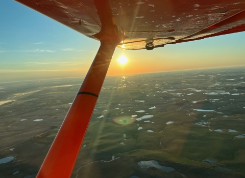
That turned out to be fortunate because another weather system moved in and we were unable to fly again as the rain returned. Now I’m sure many of you may be wondering why we don’t fly when it’s raining and why that matters. We fly the survey at approximately 100-150 feet above ground level. At that height above ground, there are literally hundreds of obstacles out there! We encounter numerous obstacles in the form of power lines, cell phone towers, radio antennas, wind turbines, water towers, etc., etc. Low light and rain on the wind screen makes it nearly impossible to see these objects and extremely hazardous to fly in these conditions. Low light also makes it difficult to identify species of ducks as well. Although it is okay to fly on a completely overcast day or occasionally get a few rain drops on the wind screen, sustained rain is hazardous. Just imagine driving your car in the rain without functioning windshield wipers, and of course, our planes do not have windshield wipers! As I always say, I don’t need perfect weather but I need good enough weather.
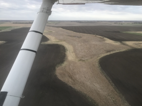
So fortunately, after this weather passed, we were able to string six more days together and complete the survey and finish the portion of North Dakota north of Bismarck, moving from Bismarck to Minot. All of North Dakota to this point looked remarkable considering what it looked like during the past several years of drought. For the past two years, most of the seasonal wetlands had been dry and many of the semi-permanent and permanent wetlands had been extremely low and many of the semi-permanent wetlands had been dry. But with a good winter in north east North Dakota and two April blizzards in western North Dakota, followed by above average rain in April and May, nearly all the wetlands were full or near full. Unfortunately, through the last couple years of drought, most of the seasonal wetlands and many of the margins of the permanent and semi-permanent wetlands had been disturbed by agricultural practices. While this has not hurt the function of the semi-permanent and permanent wetlands too much, it has pretty much rendered all of the seasonal wetlands non-functional this year from a waterfowl production standpoint. Most were no more than vegetation free mud puddles in the middle of crop fields.

The only obstacle that remained on our way to completing the survey occurred in Minot, North Dakota. The airport ground crew managed to damage the nose strut on my plane backing it into the hangar when we were done flying on the 23rd, just when we were rolling along again! This resulted in having to go to Garrison, North Dakota, meet up with Neil Kadrmas, a USFWS Region 6 pilot/biologist at Audubon National Wildlife Refuge and get a familiarization flight in Cessna 182 that I hadn’t flown for a bit. After about an hour and a half of flying with Neil, I dropped him off and flew back to Minot. We were then able to use that plane to finish the survey over the next two days.
So it was great, despite the weather and airplane issues, to be able to resume flying the Waterfowl Breeding Population and Habitat Survey this year. It was great to see the improved habitat conditions and wonderful that we had a wet April and May. Once again, it was a bit challenging to string the survey together, more challenging than most years. I hope you enjoyed this field report, gained a bit of insight on what it takes for the air crews and ground crews to conduct the survey. Most of all, I hope you are looking forward to a great fall pursuing waterfowl and the great outdoors. Until next year…
Written By