

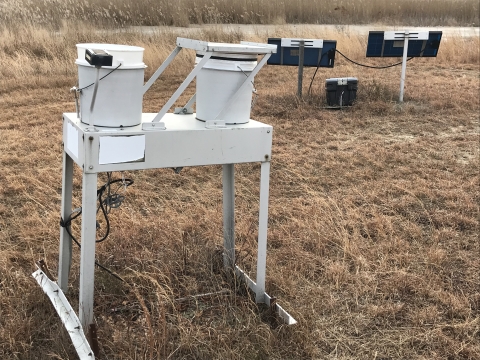
NADP (National Atmospheric Deposition Program), IMPROVE (Interagency Monitoring of Protected Visual Environments), and the RAWS (Remote Automatic Weather Stations) are partnership programs that monitor climate and weather, not only for the refuge, but as part of a larger monitoring effort that covers multiple eastern states. Additionally, every state (except Hawaii), Puerto Rico and the Virgin Island all have NADP stations. NADP collects precipitation data weekly throughout the year. Precipitation samples are measured for amounts that fell, and collected samples are weighed and placed into sterile containers. These samples are then sent to the University of Wisconsin for chemical analysis. Data collected over several decades provides information on precipitation trends and the effects of acid rain on the natural environment.
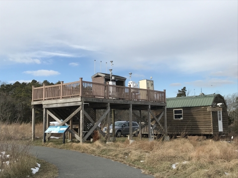
The IMPROVE air monitoring station was established on the refuge in 1991. In 1977, Congress acknowledged the uniqueness of the Brigantine Wilderness Area by naming it a Class I Air Quality Area. As a wilderness area wilderness area
Wilderness areas are places untamed by humans. The Wilderness Act of 1964 allows Congress to designate wilderness areas for protection to ensure that America's pristine wild lands will not disappear. Wilderness areas can be part of national wildlife refuges, national parks, national forests or public lands managed by the Bureau of Land Management.
Learn more about wilderness area it is afforded special protection under the Clean Air Act. Congress gave the Fish and Wildlife Service, as the Federal Land Manager of the Brigantine Wilderness Area, the responsibility to protect the air quality and air quality related values of the area from man-made air pollution. Despite this protection, many sources of man-made air pollution affect the Brigantine Wilderness area including industry, power plants, and automobiles. We work cooperatively with the NJ Department of Environmental Protection and industry and regional utilities to control air pollutant emissions in order to protect Brigantine. If Brigantine is not protected, unique wildlife and scenic values will be threatened or even lost, as has happened along much of the Atlantic Coast. The FWS hopes to preserve and protect this special area of wilderness for future generations.
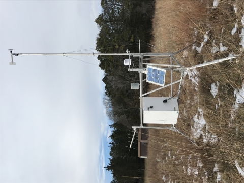
The refuge is one of nearly 2,200 facilities throughout the country that host a RAWS. RAWS are self-contained, portable, and permanent, solar-powered weather stations that provide timely local weather data used primarily in fire management. These stations monitor the weather and provide weather data that assists land management agencies with a variety of projects such as monitoring air quality, rating fire danger, and providing information for research applications.