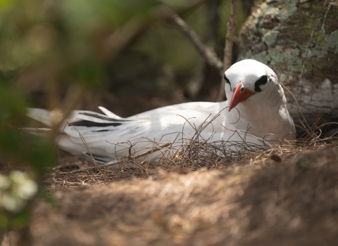
In the serene wetlands and sweeping grasslands of North Dakota, an iconic waterfowl species takes flight—the Northern pintail. These charming, dabbling ducks were once one of the most abundant duck species in North America. While waterfowl as a group have actually increased in population size, a few species like the Northern pintail have seen population declines since the 1950s. As a Bird of Management Concern, an exciting collaboration in the Central Flyway has emerged to unravel the mysteries about their migration, where they breed and where they winter, to help inform not only our basic understanding of Northern pintails, but also our management actions in both conservation delivery and harvest management.
Today, the Northern pintail breeding population falls short of the North American Waterfowl Management Plan objective of 5.5 million birds, with the latest population estimate from last year’s Waterfowl Breeding Population and Habitat Survey (also known as the May Survey) at around 1.78 million. Through collaborations with the U.S. Fish and Wildlife Service (USFWS) Migratory Bird Program, the North American Waterfowl Management Plan has created the foundation for partners to work towards achieving conservation goals that affect Northern pintails; however, there is still a need to better understand Northern pintail habitats on their breeding, wintering, and staging areas. To address these questions, a coordinated partnership was formed between the North Dakota Game and Fish Department (NDGFD), U.S. Geological Survey (USGS), USFWS Migratory Bird Program and National Wildlife Refuge System to collaborate on a GPS telemetry project. The project, led and designed by NDGF Migratory Game Bird Management Supervisor Mike Szymanski, USGS Research Wildlife Biologist Aaron Pearse, and USFWS Migratory Game Bird Coordinator Dan Collins, started as a pilot study in 2021, and then fully began as a multi-year study in late summer 2022.

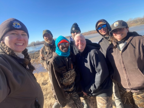
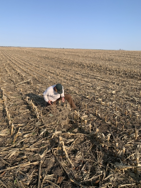
This project aims to fill knowledge gaps by collecting GPS locations from Northern pintail hens over a multi-year period, providing a clearer picture for habitat conservation on breeding, staging/stopover, and wintering areas. The process begins by capturing Northern pintail hens at National Wildlife Refuges and other preseason duck banding sites in the Missouri Coteau physiographic region of North Dakota. A winter sample of hens is also collected with help from refuge biologists and volunteers at Bosque del Apache National Wildlife Refuge in New Mexico to capture data from wintering Northern pintails in the western Central Flyway. A sample of the captured hens are then selected for the study and carefully moved into separate holding boxes. The selected hens are transported to a skilled wildlife veterinarian who temporarily anesthetizes the birds and quickly conducts the implantation procedure. After the birds have recovered, they are then released back to the location where they were captured.
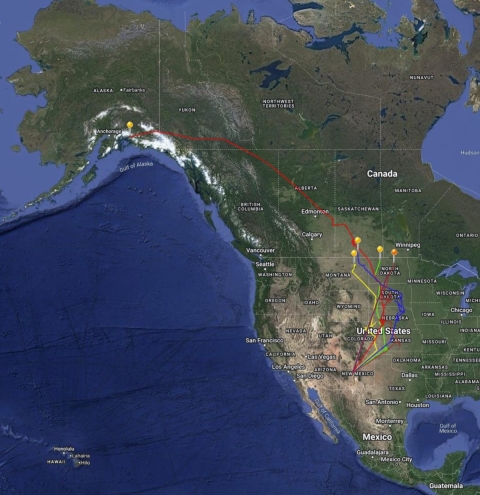
The transmitter device used in this project has a small antenna extending out the back of the bird, which is what will transmit data to the GPS. Throughout the following year, extensive location data from the Northern pintails’ GPS will be collected and transferred to the research team via a mobile system using a wireless cellular connection. Mobile transmitter systems like this operate at a higher capacity, with more direct data transfer compared to a satellite system. The transmitters used for this study can also provide accurate descriptions of where these hens have been, without researchers having to physically collect the data from the transmitters once released or rely on recatching birds like traditional banding methods; and while population surveys provide an overview of Northern pintail numbers, the GPS data collected through telemetry offer a more comprehensive picture of the species habitat use and movement during migration, breeding, and wintering. Being able to “see” where the birds have been throughout their annual cycle helps connect a lot of dots and provide a better picture of the connections between all three of our keystone monitoring programs: Breeding Population Survey (BPOP), preseason banding, and harvest surveys.
“A project like this one fills in so many knowledge gaps. While a lot is known about Northern pintails, we never really see the whole picture. Population surveys do a pretty good job of telling us how many birds there are, but we don’t quite get the whole story for habitat use.”- Mike Szymanski, NDGFD, Migratory Game Bird Management Supervisor
Collins and USFWS Central Flyway Representative Tom Cooper added, “Projects such as this require broad coordination to be successful and we are happy the USFWS can play a small part in supporting this research to better understand the full annual cycle of the Northern pintail in the Central Flyway including migration chronology, connectivity between breeding and wintering areas, and habitat use.”
While this study is anticipated to continue through January 2026, data acquisition will continue for an additional year or so after the last birds are tagged. The resulting data will greatly expand our knowledge of Northern pintail movements, thus informing future habitat conservation efforts on a landscape scale. Information gained from this project may also provide valuable insights useful for informing adaptive harvest management decisions to set hunting season frameworks. By filling crucial knowledge gaps and aligning with the North American Waterfowl Management Plan objectives, this project brings us closer to understanding the intricate web of Northern pintail behavior and habitat use.
All banding, marking, and sampling is conducted under a federally authorized Bird Banding Permit issued by the U.S. Geological Survey.