


Visit Us
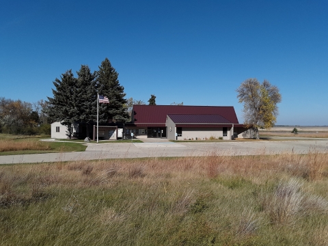
The Wetland Management District office is located within the J. Clark Salyer NWR Complex headquarters located 2 miles north of Upham off North Dakota Highway 14.
A variety of complimentary informational brochures and maps are available at the headquarters. These describe the locations of the Waterfowl Production Areas managed by J. Clark Salyer WMD. Refuge complex staff are also available to answer questions during normal office hours.
The J. Clark Salyer Wetland Management District is open to the public year-round.
Location and Contact Information
About Us
J. Clark Salyer Wetland Management District is located in north-central North Dakota. The District covers approximately 8,354 square miles in Renville, Bottineau, Rolette, McHenry, Pierce, and Ward counties. Within the wetland management district wetland management district
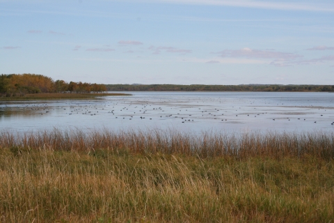
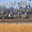
A wetland management district is a U.S. Fish and Wildlife Service office that manages waterfowl production areas in one or more counties. Waterfowl production areas are small natural wetlands and grasslands that provide breeding, resting and nesting habitat for waterfowl, shorebirds, grassland birds and other wildlife. The Fish and Wildlife Service acquires waterfowl production areas under the authority of the Migratory Bird Hunting and Conservation Stamp Act, primarily using funds from the sale of Federal Duck Stamps. The Refuge System’s 38 wetland management districts comprise thousands of waterfowl production areas – almost all in the Prairie Pothole Region of the Northern Great Plains.
Learn more about wetland management district , the U.S. Fish and Wildlife Service manages 34,403 acres of waterfowl production areas, 134,008 acres of wetland easements, 98,706 acres of grassland easements, 18,371 acres of Farmers Home Administration conservation easements, and 8,062 acres of easement refuges.
The wetland management district was formed to manage waterfowl production area waterfowl production area
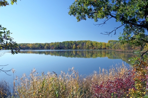
Waterfowl production areas are small natural wetlands and grasslands within the National Wildlife Refuge System that provide breeding, resting and nesting habitat for millions of waterfowl, shorebirds, grassland birds and other wildlife. Virtually all waterfowl production areas are in the Prairie Pothole Region states of Iowa, Minnesota, Montana, North Dakota and South Dakota.
Learn more about waterfowl production area the Wetland and Grassland Easement Program, both aimed at protecting and restoring crucial grasslands and wetlands for waterfowl production.
Although waterfowl production areas, easements, and national wildlife refuges account for less than 2 percent of the landscape in the Prairie Pothole Region states, they are responsible for producing nearly 23 percent of this area's waterfowl. That is why working with private landowners through voluntary partnerships to enhance grasslands and wetlands is so critical to protecting waterfowl.
Nearly 800,000 people visit waterfowl production areas each year. By law, these areas are open to hunting, fishing and trapping in accordance with State regulations. Other important wildlife-dependent uses allowed include wildlife observation, photography, and environmental education.
What We Do
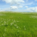
Habitat management at J. Clark Salyer Wetland Management District includes rotational grazing, rotational haying, prescribed burning, and farming. A combination of these habitat management tools as well as spraying chemicals and using biological agents help control noxious weeds and other exotic species. Haying, grazing, and farming are accomplished cooperatively with private landowners.
These habitat management practices improve and maintain grasslands for waterfowl and other nesting birds. By providing permanent secure habitat, these critical areas help sustain North America's waterfowl populations.
If you are interested in becoming a cooperator or learning more about our management practices, please contact us.
Our Species
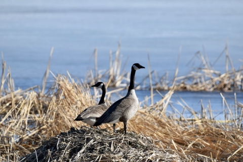
J. Clark Salyer Wetland Management District provides important habitat for thousands of migratory birds. Over 250 bird species are found here, including waterfowl, shorebirds, raptors, and songbirds. Many mammals, reptiles, amphibians, and insects make their homes here as well.