


Visit Us
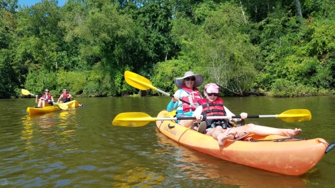
The refuge has so much to see, including the visitor center that opened in the summer of 2014. There are three units to explore: Big Sandy, Duck River and Busseltown, each with its own charms, beautiful views and opportunities to connect with nature.
Location and Contact Information
About Us
Located on and around Kentucky Lake in Northwest Tennessee, the refuge’s three units, Big Sandy, Duck River, and Busseltown, stretch for 65 miles along the Tennessee River. Established in 1945, the refuge is managed by the U.S. Fish and Wildlife Service, and was created as an area for migratory birds. The refuge's primary management is to provide food and protection for waterfowl. Currently refuge habitats include agricultural crops such as corn, milo and winter wheat; natural plants that grow in moist soil conditions; vegetated wetlands, mudflats and forest lands. The resulting combination of agricultural grains, natural foods and protected areas, sustain waterfowl through the winter months. On the refuge they are able to forage for the food and nutrients they need to support their return to spring breeding grounds in good condition.
What We Do

Wildlife conservation is at the heart of the National Wildlife Refuge System. Refuges strive for biological integrity, diversity and environmental health. Much of the management work of refuges is to maintain, enhance or restore intact and self-sustaining habitats and wildlife populations that existed during historic conditions.
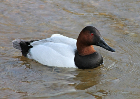
Our Species
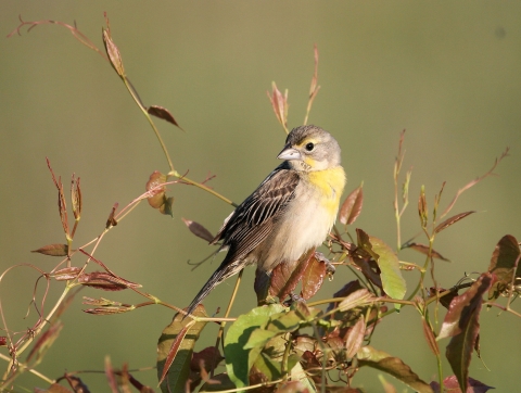
The Tennessee National Wildlife Refuge contains more than 50,000 acres of diverse habitats that support an equally diverse array of wildlife. Habitat types found on the refuge include rivers and streams, freshwater marshes, water impoundments, agricultural lands, bottomland hardwoods and oak-hickory forests. The refuge’s diversity of habitats also supports breeding, wintering, and migration habitat for over 300 bird species, as well as habitat for 51 mammals, 89 reptiles and amphibians, and 144 species of fish. Large populations of white-tailed deer can be found throughout the area, along with smaller animals such as raccoons, squirrels, beavers, rabbits, and turkeys.
Our Library
The refuge virtual library is a collection of documents and brochures for all your reading needs.


