


Visit Us
National wildlife refuges offer us all a chance to unplug from the stresses of daily life and reconnect with our natural surroundings. Trempealeau National Wildlife Refuge lies within the Mississippi flyway, along the Mississippi River in western Wisconsin. It is an isolated backwater, cut off from the Mississippi and Trempealeau rivers by dikes. It is a resting and feeding area for waterfowl and other birds. Whether it is by foot, bicycle or car, let the refuge satisfy and soothe your spirit.
Driving Directions
W28488 Refuge Road
Trempealeau, Wisconsin 54661
From La Crosse, Wisconsin, take Route 53 north to Route 54 west. Follow Route 54 to Centerville and continue 3.1 miles to West Prairie Road. Turn left on West Prairie Road and drive one mile to the refuge entrance.
From Winona, Minnesota take Route 43 across the Mississippi River into Wisconsin. Turn right onto Route 54 east. Travel 5.7 miles to West Prairie Road. Turn right onto West Prairie Road and drive one mile to the refuge entrance.
Fees
There is no charge to visit the refuge, but certain activities such as hunting and trapping require a permit and have a fee included.
Restrooms
Restrooms are available inside the visitor contact station during normal operating hours. There are also pit toilets located in the parking lot adjacent to the visitor center that are open at all times.
Points of Interest
Plan to explore the 4.5 mile self-guided Prairie’s Edge Tour Loop, which is accessible by bikes, pedestrians and vehicles. Along the tour, visit the observation deck and look through the high-powered spotting scopes. There are several short self-guided walking trails and walking on top of the refuge dikes provide some excellent wildlife viewing opportunities. Plan to spend time browsing the bookstore in the visitor contact station operated by the Friends of Trempealeau Refuge.
What To Do
If you have 15 minutes
- Grab your binoculars and stop by to see what birds are migrating through! The observation deck near the visitor center provides an expansive view of the main pool area where bald eagles, tundra swans, geese and ducks can be seen from mid-March well into April.
If you have one hour
- Take a drive around the Prairie’s Edge self-guided auto tour loop. This four-mile drive will acquaint you with three major plant communities on the refuge: sand prairie, backwater marsh and hardwood forest.
If you have half a day or more
- Grab your canoe or kayak and hit the water! The refuge sits on the backwaters of the Mississippi River and provides an opportunity to take a leisurely paddle to observe all of the aquatic wildlife this special place has to offer.
- Put on your comfortable walking shoes and explore the trails! There are several short self-guided walking trails and longer walking opportunities on top of the refuge dikes, which provide some excellent wildlife viewing opportunities.
- Grab your fishing pole and tackle box and spend a leisurely day fishing at various locations around the refuge.
Know Before You Go
Remember to bring
- Sunglasses
- Bug spray or head net
- Hat
- Water bottle
- Sunscreen
- Comfortable shoes for walking or hiking
Pets
Only service dogs are allowed in the visitor contact station. Dogs are welcome, on-leash, on refuge grounds and trails. Please clean up after your pets!
Visitor Tips
- Viewing wildlife is best in spring and fall as migrating birds pass through and usually dawn and dusk when wildlife is moving the most
- Warbler watching is great in late April or early May
- Information kiosks are located at observation points and at trailheads. The visitor center is home to a large relief map and an eBird computer station which logs real-time data of bird observations. Stop in and check out what birds visitors have seen and where.
Activities
Whether you prefer to watch wildlife from the comfort of your car or take a hike or bike on one of the many trails, there is something for everyone at Trempealeau National Wildlife Refuge. There are various hunting and fishing opportunities as well for visitors to take part in this longstanding tradition.
Trails
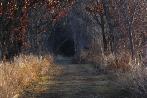
Hiking Trails
Lower Diversion Dike
Open Season: Year round
Length: 2 miles, one way
Location of trail: East border of the refuge
Surface Hard-crushed gravel
Difficulty: Easy
Information: This trail borders the refuge and is a great opportunity to view water birds and other wildlife. It takes the visitor to the base of Trempealeau Mountain, which is closed to the public so it ends at that point.
Kieps Dike
Open Season: Year round
Length: 0.7 miles, one way
Location of trail: Trailhead located at the Keips Island Boat Landing
Surface Hard-packed gravel
Difficulty: Easy
Information: This trail is one way in and out and is a dike that takes you through the forest on the island and opens up to have water on both sides. It is great for bird watching and views of Trempealeau Mountain. There is no snow removal in the winter but is still open for hiking.
Delta Road
Open Season: Year round
Length: 2 miles
Location of trail: Located off the Marshland Road
Surface Hard-packed gravel
Difficulty: Easy
Information: Delta Road is a dike that leads you into the middle of the refuge and ends at Delta Point. It is hard-packed gravel and there is no snow removal in the winter but is still open for hiking.
Marshland Road
Open Season: Year round
Length: 1.2 miles
Location of trail: Trailhead starts at the Marshland Access Parking Area located off Hwy 35/54.
Surface Hard-packed gravel
Difficulty: Easy
Information: This is a bi-level dike road that is flat and can be used as an alternative entrance to the refuge during times of flooding, but is otherwise closed to vehicle traffic. It is also part of the Great River Bike Trail.
Woods Nature Trail
Open Season: Year round
Length: 0.5 miles
Location of trail: Trailhead is located next to visitor contact station.
Surface: Dirt and gravel
Difficulty: Easy
Information: This trail is one of the best places to view warblers during the spring and fall migration.
Pine Creek Dike
Open Season: Year round
Length: 0.5 miles one way
Location of trail: Trailhead is located next to visitor contact station.
Surface Dirt and gravel
Difficulty: Easy
Information: This trail will take you through the woods and past a wetland as you head to the point of the dike where you will have water on either side of you. It’s a great place to see shorebirds, listen for frogs and catch sight of pelicans soaring overhead.
Prairie View Loop
Open Season: Year round
Length: 0.71 miles
Location of trail: Located on the west side of the auto tour loop
Surface Hard-packed gravel
Difficulty: Easy to moderate
Information: This trail takes you through the rolling hills of the prairie where you can find beautiful prairie flowers blooming in the summer and watch for birds such as bobolinks and eastern meadowlarks.
River Bottom Road
Open Season: Year round
Length: 1.2 miles
Location of trail: Located off of Hwy 35/54 East of Bluff Siding, Wisconsin
Surface Crushed gravel
Difficulty: Easy
Information: This is a dike road that is open for hiking and is a great place to observe wetland wildlife. It is hard-packed gravel and there is no snow removal in the winter but is still open for hiking.
Oxbow Dike
Open Season: Year round
Length: 0.65 miles
Location of trail: Located off of Hwy 35/54 East of Bluff Siding, Wisconsin
Surface Crushed gravel
Difficulty: Easy
Information: This is a dike road that you can only get to from the River Bottom Road. It is hard-packed gravel and there is no snow removal in the winter but is still open for hiking.
Snowshoe and Ski Trails - Seasonal and not groomed
Grand Tour
Open Season: Winter
Length: 3 miles
Location of trail: Refuge border
Surface Snow packed
Difficulty: Easy to Moderate
Information: This trail follows the outer border of the refuge and can be moderate due it’s length and slight changes in elevation
Access Maintenance
Open Season: Winter
Length: 0.2 miles
Location of trail: Next to maintenance shope
Surface Snow packed
Difficulty: Easy
Information: This short trail is one access point to the other longer trails and is located on the west side of the maintenance shop parking lot.
Access Prairie
Open Season: Winter
Length: 0.4 miles
Location of trail: Parking area near the refuge entrance on the entrance road
Surface Snow packed
Difficulty: Easy
Information: This trail begins at the parking area near the refuge entrance and is one of the access points for the other trails.
Access Marshland
Open Season: Winter
Length: 1.2 miles
Location of trail: Marshland Road
Surface Snow packed
Difficulty: Easy
Information: This trail starts at the Marshland Access Parking Area located on Hwy 35/54 and is the back entrance to the refuge which will connect to the other trails as well.
Red Pines Run
Open Season: Winter
Length: 0.9 miles
Location of trail: Starts from the Access Maintenance Trail
Surface Snow packed
Difficulty: Easy to moderate
Information: This trail can only be accessed by other trails and is rated easy to moderate for slight elevation changes.
White-Tail Woods
Open Season: Winter
Length: 1.1 miles
Location of trail: Starts from the Access Maintenance Trail
Surface Snow packed
Difficulty: Easy to moderate
Information: This trail can only be accessed by other trails and is rated easy to moderate for slight elevation changes.
Rolling Dunes Dash
Open Season: Winter
Length: 1.2 miles
Location of trail: Parking area of the Prairie View Trail
Surface Snow packed
Difficulty: Easy to moderate
Information: This trail begins at the parking are for the Prairie View Trail and is rated easy to moderate for slight elevation changes.
Pine Creek Pass
Open Season: Winter
Length: 0.5 miles
Location of trail: Starts at Parking area of the Prairie View Trail
Surface Snow packed
Difficulty: Easy
Information: This trail connects the White-tail Woods Trail to the northern portion of the Grand Tour Trail.
Bike Trail
Great River State Bike Trail
Open Season: Year round
Length: 2 to 6 miles
Location of trail: Trailhead starts at Marshland Access off Hwy 35/54
Surface Hard-packed gravel
Difficulty: Easy
Information: There is a section of the Great River State Trail that goes through the refuge. If you choose to ride straight through it is about two miles to the next parking area at the refuge entrance, but if you want to explore the refuge more there is a 4.5 mile option loop that takes you through the refuge and follows the auto tour route.
Other Facilities in the Complex
Trempealeau National Wildlife Refuge is part of the Upper Mississippi River National Wildlife and Fish Refuge Complex.

Rules and Policies
The refuge land are open from dawn to dusk and there are various public use regulations to know before you go. Some areas are closed for certain uses such as bicycles or vehicles, and these are posted through the refuge. Dogs must be leashed and we ask you please pick up after your pets. Leave no trace! Please pack it in and pack it out.
For a full list of Trempealeau National Wildlife Refuge rules and regulations, please contact the refuge office.
Refuge Hours - The refuge is open during daylight hours only.
Closed Areas - Public entry is not allowed in areas posted “area closed”.