


UPDATED April 29, 2024
ALERTS:
- Phones
Our phone system is still down as we work through some software security updates. Please contact us by email at sacramentovalleyrefuges@fws.gov
- Intermittent Closure of River Units starting Monday April 29, 2024
There will be intermittent closures of various units on the Sacramento River NWR starting 4/29 for follow-up fuel reduction work. Crews will be starting at the Packer Unit and moving north through the River Refuge. Expect a sign at the gate if a unit is closed. Thank you for your patience, understanding and flexibility while we get this important work done!
Request for Scoping Comments for the Draft Environmental Assessment for the Sacramento National Wildlife Refuge Complex, San Luis National Wildlife Refuge Complex, and Stone Lakes National Wildlife Refuge for Management of Aquatic Invasive Plants
The U.S. Fish and Wildlife Service (Service) is preparing a Draft Environmental Assessment (EA) to evaluate the potential physical, environmental, cultural, and socioeconomic effects associated with the management of aquatic invasive plants within and surrounding the Butte Sink Wildlife Management Area (WMA), Colusa National Wildlife Refuge (NWR), Delevan NWR, Sacramento NWR, Sacramento River NWR, Steve Thompson North Central Valley WMA, Sutter NWR, San Joaquin River NWR, San Luis NWR, Merced NWR, Grasslands WMA, and Stone Lakes NWR (hereto referred to as the “Covered Refuges”).
View or download the full scoping letter here.
The Service respectfully requests that you consider the proposed action and provide any comments and/or available information that you may have regarding resources within and adjacent to the Covered Refuges. At this time, we are seeking input to help identify the scope of issues and potential alternatives to be analyzed in the Draft EA, as well as regulatory concerns and any other relevant information. Please provide any comments in writing via email by 5:00 P.M. on May 25, 2024 to fw8plancomments@fws.gov. Before including your address, phone number, email address, or other personal identifying information in your comment, please be aware that your entire comment, including your personal identifying information, may be made publicly available at any time. While you can ask us in your comment to withhold your personal identifying information from public review, we cannot guarantee that we will be able to do so.
Visit Us
Welcome to the Sacramento River National Wildlife Refuge!
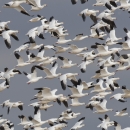
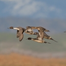
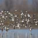
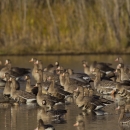
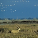
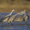
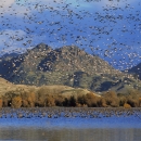
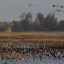
Sacramento River National Wildlife Refuge is just one of the 5 National Wildlife Refuges and 3 Wildlife Management Areas that make up the Sacramento National Wildlife Refuge Complex. Sacramento River NWR offers a variety of recreational activities for visitors: hunting, fishing, hiking, photography, and wildlife viewing. With 24 units open to the public and the scenic Sacramento River running through many of these units, there's something for everyone!

PLAN YOUR VISIT <-- Click here to find all the information you need to visit the Complex.....
• ACTIVITIES
• visitor center
• auto tours
• trails
• photography
• bicycling
• hunting
• environmental education
• HOURS
• FEES AND PERMITS
• RULES AND POLICIES
• ACCESSIBILITY
• DIRECTIONS
• OTHER LOCAL INFORMATION
Trails
Visit our Unit Maps and Recreation page to find details, maps and brochures about the units of the Sacramento River NWR.
Eight of Sacramento River NWR's units have trails:
- Rio Vista - on South Avenue east of Corning; 6.5 miles of marked trails
- Pine Creek - on Highway 32 west of Hamilton City; 3 miles of marked trails
- Capay - on Road 23, off of Highway 45 south of Hamilton City; 3 miles of marked trails
- Ord Bend - on Ord Ferry Road just west of Sacramento River; 1 mile of marked trails
- Sul Norte - on Highway 162 west of Butte City; 2.5 miles of marked trails
- Codora - access through the Sul Norte parking area; 4.5 miles of marked trails
- Packer - on Highway 45 north of Princeton; 1.5 miles of marked trails
- Drumheller - on Road 67 southeast of Butte City; 0.4 miles of marked trails
Important Notes:
- Bicycles: from May 15 - August 15 bicycles are permitted on the trails except at Ord Bend.
- Hunting: some units allow hunting between August 1 - May 31, so check the table on our Unit Maps and Recreation page if you are concerned about user-overlap.
- Restrooms: restrooms are only available at Sul Norte unit and Llano Seco unit.
- Wildlife Viewing: all areas have riparian riparian
Definition of riparian habitat or riparian areas.
Learn more about riparian habitat that offer great viewing of songbirds between March and late May.
Be Prepared! These are natural and wild areas. You may encounter ticks, mosquitoes, wasps, yellow-jackets, bees, poison oak, stinging nettle, poison hemlock, rattle snakes (Sac River NWR) and mountain lions.
Other Facilities in the Complex
The Sacramento River NWR is part of the Sacramento National Wildlife Refuge Complex. The Complex is comprised of 5 National Wildlife Refuges (Sacramento, Delevan, Colusa, Sutter and Sacramento River NWRs) and 3 Wildlife Management Areas (Willow Creek-Lurline, Butte Sink and Steve Thompson North Central Valley WMAs). Sacramento NWR, located near Willows, CA, serves as the headquarters for the Complex. Find out more about each Refuge or Wildlife Management Area below.
Rules and Policies
Plan Your Visit <-- Please see the Rules and Policies section on our Plan Your Visit page
Locations
For directions to the Sacramento River NWR units that are accessible by vehicle, visit the Maps page.