
Photo By/Credit
Amber McCullum/Bay Area Environmental Research Institute, NASA Ames Research Center
Date Shot/Created
07/13/2022Media Usage Rights/License
Public Domain
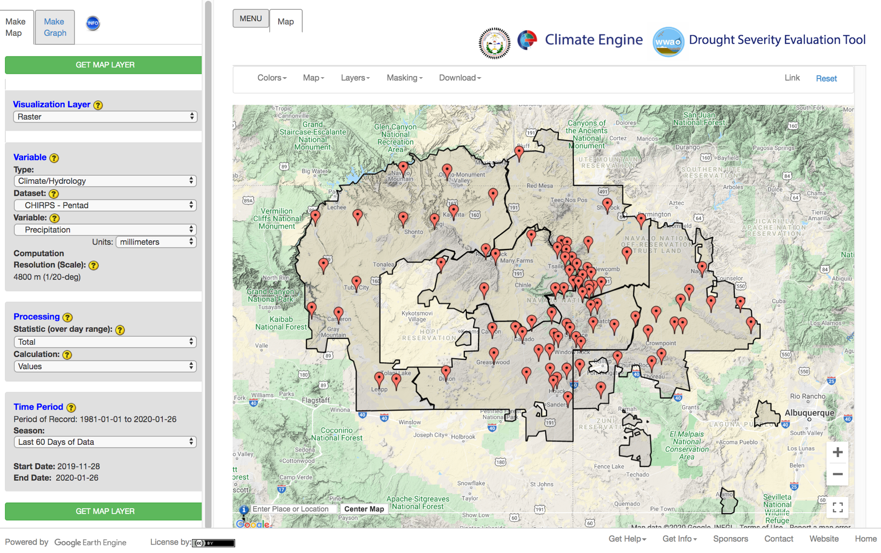
Image
The Drought Severity Evaluation Tool (DSET) mapping interface. The Navajo Nation Agency boundaries and the network of rain gauges are displayed. The visualization panel on the left allows the user to define the data, statistic, and time period of interest.