Use Layers from the FWS Land Mapper in Other Mappers
All the data layers in the FWS Land Mapper are publicly accessible and can be used in other ArcGIS Online-based mapping applications. The only requirement is that the other online mapper must include the Add Data tool, or an equivalent function. You might need to do this if, for example, you need to see the boundaries of National Wildlife Refuges, and the other mapper does not include those layers. In this case, you can add the National Wildlife Refuge boundaries to the other mapper.
FWS Land Mapper Formats that can be Imported into Other AGOL-based Mappers
|
|
GeoJSON (Geographic JavaScript Object Notation) This is a standard format that includes the geometry of features plus their attbitute values. It is widely used by ESRI's ArcGIS system, and any other program that supports the GeoJSON format. |
|
|
|
|
|
AGOL hosted layer (ESRI ArcGIS Online hosted layer) Feature layers that are hosed on the ArcGIS Online platform. To add layers, you can use the AGOL Search function, or directly enter a hosted feature layer's full URL. Feature geometry and feature attributes are supported. |
How to use FWS Land Mapper Layers in Other Mappers
The primary method to use the FWS Land Mapper layers in other mappers is to use that mapper's Add Data tool, or equivalent function. If the other mapper does not provide a means of importing or adding data layers, you will not be able to use the FWS Land Mapper's layers. Additionally, the other mapper may, or may not, support one or both of the data formats described above. The U.S. Fish & Wildlife Service has no control over, or input on the function of online mapping applications that are developed and maintained by other organizations.
To add FWS Land Mapper data in the GeoJSON format to another online mapper, you must first use the FWS Land Mapper's Query tool to select the desired features from a data layer, and then export the selected features to a GeoJSON file. The GeoJSON file can then be imported into the other mapper, if the other mapper supports the import of GeoJSON files.
Alternatively, if you want to add everything within an FWS Land Mapper data layer to another mapper, you can simply copy and paste the FWS Land Mapper layer's URL into the other mapper's Add Data tool, or equivalent function.
Export and Import a GeoJSON File
1) Use the FWS Land Mapper's Query tool to select the desired features from one of the FWS Land Mapper's layers. To use the Query tool, follow these steps. Note: for this purpose, you don't have to do Stage 2 of the Query tool instructions.
2) In Stage 3, Step 7 of the Query tool instructions, don't choose the CSV option. Instead, select Export to GeoJSON.
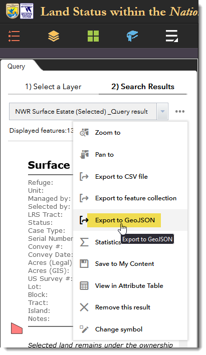
Select Export to GeoJSON
3) Select a location on your computer to store the file, and give the file a name.
4) Open the other online mapper to which you want to import your new GeoJSON file. This example uses the BLM-Alaska Lands, Minerals and Realty mapper.
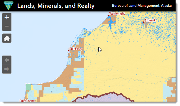
This is the BLM-Alaska Lands, Minerals and Realty mapper
5) In the BLM-Alaska mapper, select the Add Data tool in the upper-right corner of the mapper.
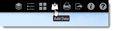
Click Add Data
6) In the Add Data panel, click the File tab and either browse for the GeoJSON file that you saved in Step 3 above, or drag the file from your Windows Explorer into the Add Data panel.
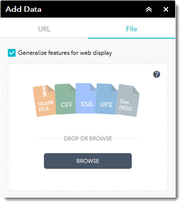
Add your GeoJSON file to the File tab of the Add Data panel
7) Depending on the layers that are displayed in the BLM-Alaska mapper, you may have to turn some of them off and/or change the basemap to make your newly imported GeoJSON features visible.
Copy and Paste an FWS Land Mapper Layer's URL into Other Mapper
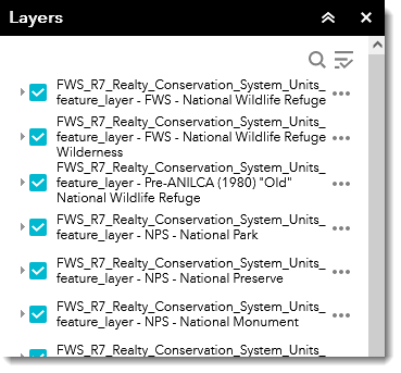
1) Open the FWS Land Mapper, then click on the Layers icon to open the Layers panel.
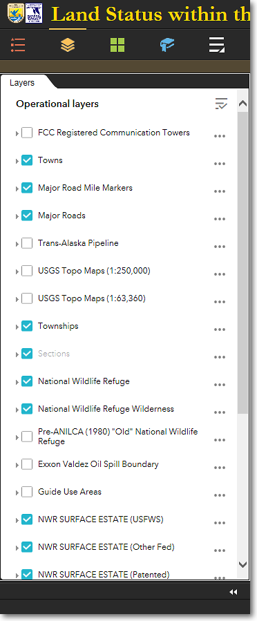
The FWS Land Mapper's Layers panel
2) Find the layer that you want to add to the other online mapper, and click the three dots to the right of the layer's name. Then from the pop-up menu, select Show item details.
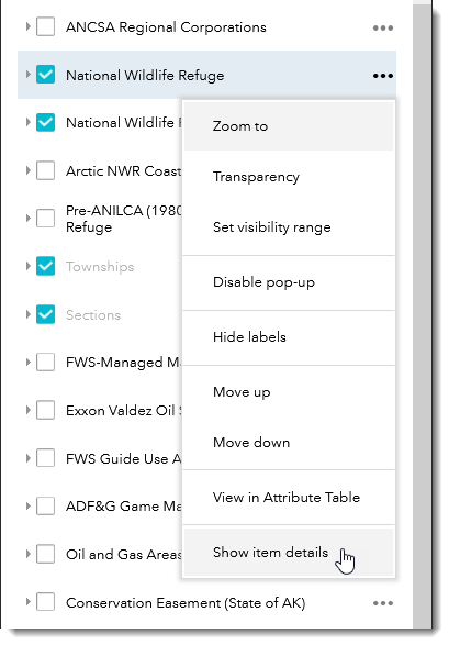
Select Show item details
3) On the web page that appears, there will be a section that shows the URL of the layer that you chose (you may have to scroll down the page to see the URL). Click the Copy icon that's to the right of the URL. The full URL of the FWS Land Mapper's layer will be copied to your computer's clipboard.
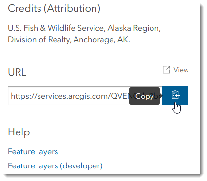
Click the Copy icon to the right of the URL
4) In the other online mapper (again, using the BLM-Alaska Lands, Minerals and Realty mapper for this example), open the Add Data tool, click the URL tab, and paste the copied URL into the URL field. Then click Add.
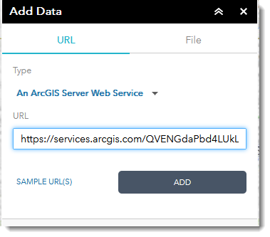
Paste the FWS Land Mapper layer's URL into the URL field and click Add
5) The FWS Land Mapper layer is now added to the BLM-Alaska Lands, Minerals and Realty mapper. Open its Layers panel. The newly added FWS Land Mapper layer will be listed at the top of the other mapper's Layers panel. Turn layers on or off as desired.
FWS Land Mapper layer added to the BLM-Alaska Lands, Minerals and Realty mapper
|
|
User-added data layers are TEMPORARY Data layers that you add to other online mappers are temporary. They are removed from the mapper when: •You remove them manually •You close your web browser •Your clear your web browser's cache User-added data layers will be retained when... •You minimize or close the Add Data panel •You switch to another tool panel •You leave your web browser open or minimize the browser window |
The Region 7 Land Mapper was developed, and is maintained by, the U.S. Fish & Wildlife Service, Region 7, Division of Realty. Questions, comments,and suggestions should be directed to [email protected]
This page was last updated: Thursday, March 13, 2025