Visit Us
Things to do: Wildlife viewing and photography, boating, fishing, waterfowl hunting, auto touring, touring the Gallagher State Fish Hatchery, and history touring
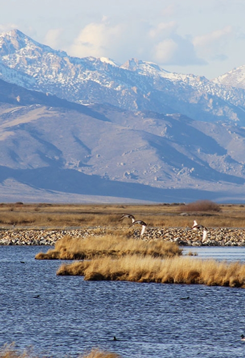
Ruby Lake serves as a magnet for a wide diversity of wildlife species and is strategically located along migration corridors serving both the Pacific and Central Flyways. The refuge has been identified as one of 500 Globally Important Bird Areas by the American Bird Conservancy.
The National Park Service designated the South Marsh a National Natural Landmark National Natural Landmark
The National Natural Landmarks Program preserves sites illustrating the geological and ecological character of the United States. The program aims to enhance the scientific and educational value of the preserved sites, strengthen public appreciation of natural history and foster a greater concern for the conservation of the nation’s natural heritage. The program was established in 1962 by administrative action under the authority of the Historic Sites Act of 1935. The first National Natural Landmarks were designated in 1963. Today, there are more than 600 National Natural Landmarks in 48 states, American Samoa, Guam, Puerto Rico and the U.S. Virgin Islands.
Learn more about National Natural Landmark because of the biological diversity and pristine condition of the habitat. The refuge is one of the most important waterfowl nesting areas in the Great Basin and Intermountain West.
The South Marsh supports the largest population of nesting canvasback ducks west of the Mississippi River (outside Alaska), and holds the highest concentration of nesting canvasbacks in North America. Due to habitat loss elsewhere in the Great Basin, the refuge has become increasingly important to resident wildlife, including mule deer, pronghorn antelope, and sage grouse. The refuge fishery is popular with local anglers.
Locations
How to Get Here
Visitors must travel 13 to 30 miles of gravel road to reach the Refuge from any direction. Harrison Pass, a steep, rough, and winding road, is not passable in winter and is never recommended for large trailers or motor homes. Routes from Highway 50 can be very muddy to impassable in wet weather or during snow-melt. Drifting snow can make travel on any route impossible except for the largest of 4WD vehicles. Visitors should check with Refuge headquarters about road conditions, especially November through May.
Directions from Elko via Harrison Pass: Fifth Street in Elko turns into State Route 227/Lamoille Highway as you head south. Alternatively State Route 227 may be reached from 12th Street. Travel 7 miles southeast on State Route 227 to the intersection with State Route 228 in Spring Creek. Turn right and take Route 228 thirty-nine miles south until it turns into a dirt road leading to Harrison Pass. Continue 4.2 miles over Harrison Pass until the road dead ends at a T-intersection with Ruby Valley Road*. Turn right and take the well-maintained dirt and gravel road south approximately 8 miles to the Refuge headquarters. The 4.2 miles over Harrison Pass is not maintained in winter and may be impassable anytime between October and May.
Directions from Elko via Secret Pass: Travel 17 miles east of Elko on Interstate 80 to exit 321 and turn right on State Route 767/State Route 229 (Ruby Valley Road*) toward Halleck/Ruby Valley. Follow Ruby Valley Road for 37 miles south until it turns into a well-maintained dirt and gravel road. Continue 30 miles south to the Refuge headquarters.
Directions from Ely: Travel west on U.S. 50 for 29 miles. Take Ruby Valley Road*/County Route 3 north 50 miles to the south end of the refuge. From U.S. 50 the road is mostly unpaved dirt and tends to be rutted, potholed and rocky. All-wheel drive is not generally needed in dry, summer weather, but even with all-wheel drive it is not recommended in wet, snowy or snowmelt weather as it will be very muddy and possibly impassable.
Directions from Ely via Hwy 93: Travel north on Hwy 93 about 110 miles. Turn left on State Route 229 and follow it for 14 miles to the intersection with State Route 767/Ruby Valley Road*. Turn left. In two miles the pavement ends, but continue on the well-maintained dirt and gravel road 30 miles south to the refuge headquarters. This route is longer than via U.S. 50, but follows paved or well-maintained dirt and gravel roads all the way to the Refuge and is, therefore, a much better choice in inclement weather.
Directions from Eureka: Travel east on U.S. 50 for 16 miles. Take Strawberry Road (State Route 892) north 42 miles to Overland Pass/County Route 6. Turn right and follow the road about 15 miles until it dead ends at Ruby Valley Road*/County Route 3. Turn left and head north for about a mile to the south end of the Refuge. This route can be very muddy and possibly impassable in wet weather.
Directions from Wells: Travel South on Hwy 93 for 27 miles. Turn right on State Route 229 and follow it for 14 miles to the intersection with State Route 767/Ruby Valley Road*. Turn left. In two miles the pavement ends, but continue on the well-maintained dirt and gravel road 30 miles south to the Refuge headquarters.
*Note - The main road that passes north and south through the refuge is listed on various maps as State Route 767, County Route 3 (White Pine County), County Route 788 (Elko County) and Ruby Valley Road. For consistency we refer to the entire section from I-80 to U.S. 50 as Ruby Valley Road.
Ruby Valley Road is not a usable designation for GPS navigation. Some navigation software will recognize "Ruby Lake National Wildlife Refuge, NV." Others may require that you put in Ruby Valley, NV and then keep heading south from there.
