Click here to return to the Sacramento River NWR home page
Recreation Summary and Unit Brochures/Maps:
- Units are listed from north to south.
- Click on the Unit Name to view brochure/map.
- We understand it can be difficult to print all the brochures at home. Feel free to contact us and we can mail you all the maps or individual maps. Contact us via email or call 530-934-2801.
- see Overview Map/Brochure of the Sacramento River NWR
- see Overview Map of Sacramento River NWR Hunting Access
| Units open to Public Access (click for link to Map/Brochure) | Hunting | Boat or Car Access | Hiking Trail | Picnic Table | Bicycles ** |
|---|---|---|---|---|---|
| Blackberry | B | ||||
| La Barranca | X | B | |||
| Todd Island | X | B | |||
| Mooney | X* | B | |||
| Ohm | X* | B | |||
| Flynn | X | B | |||
| Heron Island | X | B | |||
| Rio Vista | X | B & C | X | X | X** |
| Foster Island | X | B | |||
| Pine Creek | X | B & C | X | X | X** |
| Capay | X | B & C | X | X** | |
| Phelan Island | X | B | |||
| Jacinto | X | B | |||
| Dead Man's Reach | X | B | |||
| Ord Bend | C | X | X | ||
| South Ord | X | B | |||
| Llano Seco Island 1 | X | B | |||
| Llano Seco Island 2 | X | B | |||
| Sul Norte | X | B & C | X | X | X** |
| Codora | X | B & C | X | X** | |
| Packer | B & C | X | X** | ||
| Afton | X | B | |||
| Drumheller North | X | B & C | X | X** | |
| Drumheller Slough | X | B & C | X | X** | |
| Bogg's Bend | X | B & C |
* = Mooney and Ohm see brochure for details on special hunting rules
* = Codora - hunting open only to junior hunters, on weekends only. See brochure.
** = Bicycles allowed on trail only from May 15 - August 15
Click here to view Sacramento River Wildlife Area (Calif Dept Fish & Wildlife) maps/properties.
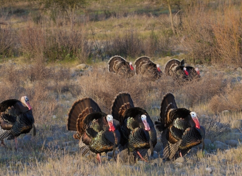
Safety:
These areas are natural and wild! You may encounter ticks, mosquitoes, wasps, yellow-jackets, bees, poison oak, stinging nettle, poison hemlock, rattle snakes, wild hogs, and mountain lions. See the Sacramento River Hunting Regulations and Information page for safety tips while visiting Sacramento River NWR.