
Photo By/Credit
NOAA/NASA GOES Project/NOAA/NASA
Media Usage Rights/License
Public Domain
Banner Image
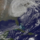
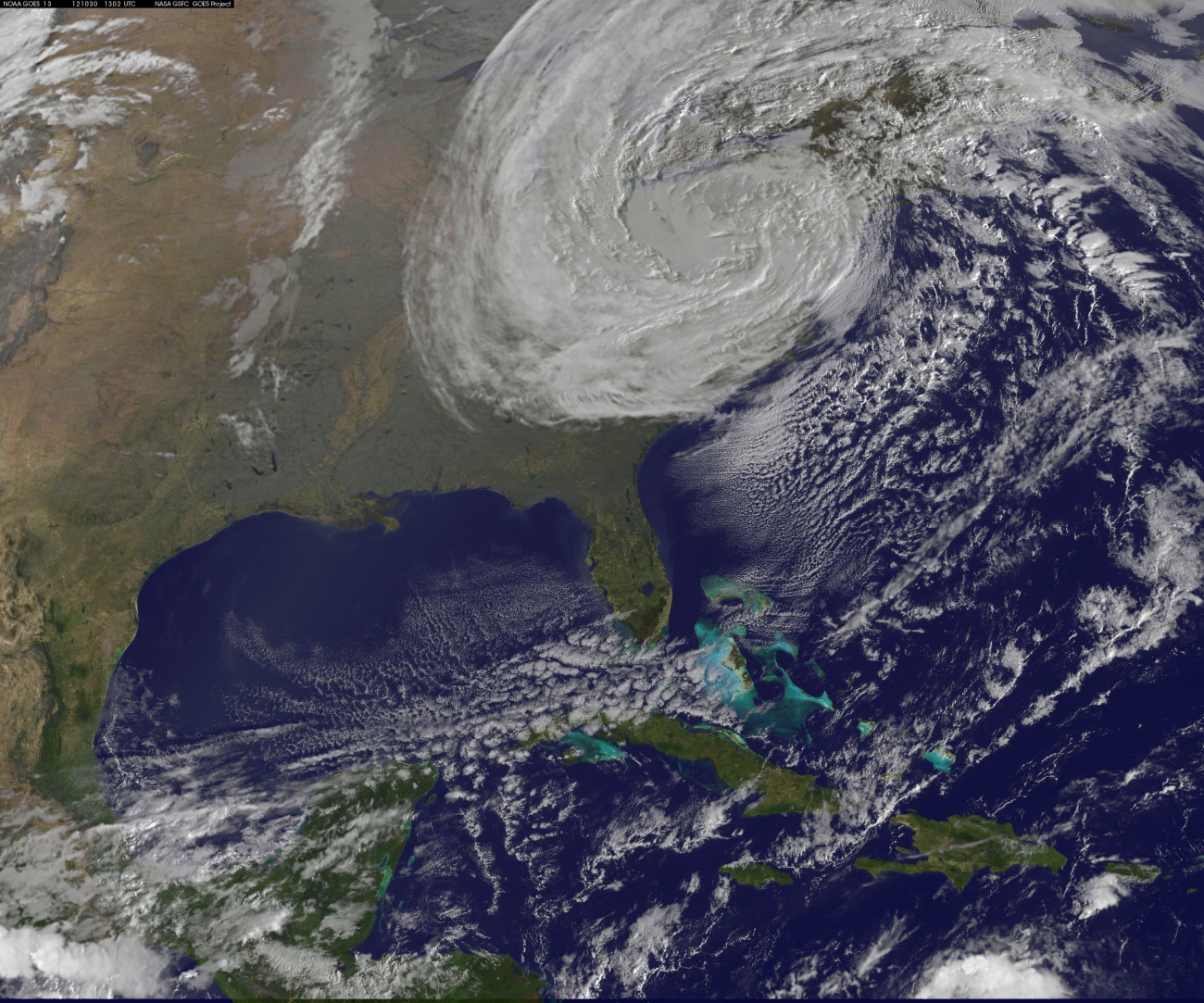
NOAA's GOES-13 satellite captured this visible image of Post-Tropical Sandy rolling inland on Tuesday, Oct. 30 at 6:02 a.m. EDT. (1302 UTC). The National Hurricane Center said that as of 5 a.m. Tuesday, the storm had move westward across Pennsylvania and was centered about 90 miles west of Philadelphia.