Wetland Classification Codes
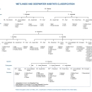
The wetland classification codes are a series of letter and number codes that have been developed to adapt the national wetland classification system to map form. These alpha-numeric codes correspond to the classification nomenclature that best describes a particular wetland habitat. For example, PFO1A = Palustrine (P), Forested (FO), Broad-leaved Deciduous (1), Temporarily Flooded (A).
To view full descriptions of wetland codes please visit the Wetlands Mapper. When a wetland polygon is clicked on, the option to view the complete code description is provided. This opens the description tab, which provides users with full details of the classification code for that wetland feature. To decode data in your own mapping environment, please refer to the Wetlands Code Definitions Download Package available below.
Wetlands Code Interpreter Tool Download
This Wetlands Decoder Tool runs in Python 3 and provides users with validation of acceptable wetland classification codes, as well as full Cowardin habitat descriptions.
Wetlands Code Interpreter - October 2023
Wetlands Decoder Table Download
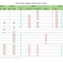
The database table in this download provides a crosswalk from U.S. Fish and Wildlife Service, National Wetlands Inventory (NWI) wetlands data, as defined by the Federal Wetland Mapping Standard, to the complete wetland definitions, as defined by the Federal Wetlands Classification Standard. The table can be joined with the NWI wetlands data using the 'Attribute' field. This will provide users with a full wetland or deepwater habitat description for each polygon. The NWI dataset and associated tables are updated on a biannual basis, typically in October and May. To ensure you have the most up to date information, please refer to the published date in the metadata, and download new data and tables regularly.
NWI Code Definitions Download Package - Last updated: October 2023
Important Classification Documents
For more information about wetland codes and the wetland classification system please refer to the documents linked below.


