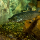
The East Fork Andreafsky River weir is located 43 kilometers upstream of the confluence of the Yukon and Andreafsky rivers, near the village of St. Mary’s. We've been operating this weir from mid-June until early August since 1994 (with the exception of 2020 due to COVID-19). This project is an important platform for assessing and reconstructing the lower Yukon River Chinook and summer Chum Salmon runs, making in-season management decisions, determining population structure structure
Something temporarily or permanently constructed, built, or placed; and constructed of natural or manufactured parts including, but not limited to, a building, shed, cabin, porch, bridge, walkway, stair steps, sign, landing, platform, dock, rack, fence, telecommunication device, antennae, fish cleaning table, satellite dish/mount, or well head.
Learn more about structure , and helping predict run strength in future years.
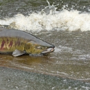
Weirs help us establish baselines and detect changes in fish populations over time. They also help fisheries managers evaluate and adjust their management actions, reconstruct past salmon abundances, and forecast future salmon returns. We use resistance board weirs in several drainages throughout central and northern Alaska to gather information about migrating fish stocks. Weirs allow our biologists to determine fish escapement (how many make it to the spawning grounds), run timing, and the sex and length composition of the migrating population.
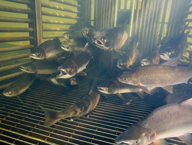
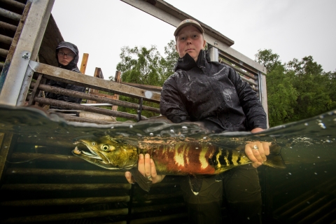
We construct our weirs with panels of evenly spaced PVC pickets aligned parallel to the direction of flow. The upstream end of each panel is anchored to the river bottom and the downstream end is lifted above the surface by a resistance board that planes upward in flowing water (hence the name "resistance board weirs"). The pickets don’t go all the way across the river, but rather guide migrating fish into a trap box that is occasionally closed so fish biologists can briefly take a few measurements and samples from a subset of fish including length, sex, scales for aging, and (at some weirs) a small fin clip for genetic analyses. This information can tell us many things about the health of salmon populations (for example, if fewer bigger, older females are returning to a particular tributary).
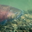
All fish pass in front of a video box on their way out. Standard video components include a sealed box filled with clear water that houses a video camera, pond lights and a digital video recorder (DVR) equipped with motion detection software. Power includes green energy sources like solar panels. With this set-up we can record passing fish 24 hours a day even when the water is cloudy. The analog video signal is routed to the DVR and converted to digital format instantaneously. The DVR removes blank footage and only reports motion events. The video footage lets us see the entire run of fish through time and only recording motion events saves staff many hours during review.
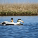
Counts from the weir project are reported back to the Fairbanks Fish and Wildlife Conservation Office daily. In addition to salmon, information on other fish species important for subsistence use is collected to understand how these populations are doing, to evaluate their recent management actions, help guide future management decisions, and to increase the overall understanding of their ecology.
Contact Information

Species
Programs
Facilities
Latest News