States
Connecticut, Delaware, Maryland, Massachusetts, New Hampshire, New Jersey, New York, Rhode Island, VirginiaOverview
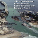
In 2014, the U.S. Fish and Wildlife Service (Service) initiated a project to modernize the maps of the Coastal Barrier Resources System (CBRS) units in the nine states along the North Atlantic coast most affected by Hurricane Sandy: Connecticut, Delaware, Maryland, Massachusetts, New Hampshire, New Jersey, New York (Long Island), Rhode Island, and Virginia (comprising 42 percent of the total existing units and 16 percent of the total existing acreage of the CBRS).
In April 2022, the Service submitted to Congress a report on the project containing the final recommended maps for congressional consideration accompanied by summaries of change for each unit. The report also contains summaries of and responses to the comments received. This project makes significant progress towards fulfilling the statutory requirement to modernize the CBRS maps (Pub. L. 109-226). The modernization effort will correct mapping errors affecting property owners; add new qualifying areas to the CBRS; and provide more accurate and accessible CBRS data for planning coastal infrastructure projects, habitat conservation efforts, and flood risk mitigation measures.
The public was provided an opportunity to comment on the proposed changes through comment periods held in 2018 and 2019 (see archived materials from the public review periods). The maps included in the report to Congress reflect appropriate adjustments to the boundaries based on public comments, CBRA criteria, and objective mapping protocols.
The final recommended maps for this project resulted in 438 units that cover a total of 846,918 acres. The report and revised maps recommended to Congress the removal of 1,361 acres (mainly uplands) that were erroneously included within the CBRS in the past. The report and revised maps also recommended the addition of 277,950 acres to the CBRS (mainly wetlands and open water) that meet the criteria for an undeveloped coastal barrier. The revised maps removed 910 structures (mostly private residential) from the CBRS and added 274 structures to the CBRS (more than half of which are park-related).
The revised CBRS boundaries (including recommended removals and additions) were adopted into law on November 25, 2024, by the Bolstering Ecosystems Against Coastal Harm Act (Pub. L. 118-117). For more information and to view the new maps, please visit our BEACH Act webpage.