Written By

How far do birds travel when they migrate? How long do they live? How are their numbers changing over time?
For centuries, people have tracked birds to answer questions about their lives and populations. But although tracking technology has evolved rapidly in recent decades — from aluminum leg bands with embossed numbers to light-sensitive geolocators — researchers who study bird behavior and migration still face a big obstacle: the ocean.
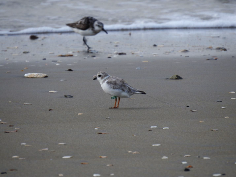
“We really have no way to know where birds are when they’re offshore,” said Emily Argo, fish and wildlife biologist for the U.S. Fish and Wildlife Service and recovery lead for the federally protected red knot and piping plover in Virginia.
Now that’s starting to change with the emergence of another kind of technology.
Along the eastern seaboard of the U.S., where wind speeds are consistently high, and the continental shelf is relatively wide, flat, and shallow, offshore wind farms are starting to come online to support the transition to renewable energy.
Thanks to the growing collaboration between conservation agencies and energy developers, offshore-wind infrastructure is generating new opportunities to track birds and bats when they're far from shore.
Eyes on the skies
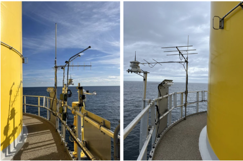
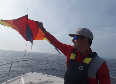
Twenty miles off the coast of Virginia, two 600-foot-tall wind turbines — about the height of the Washington Monument — rise out of the open ocean. In 2020, Dominion Energy, Inc., built the structures as a pilot for a commercial-scale offshore wind farm scheduled to break ground this year.
To monitor the pilot project’s impacts on wildlife, Dominion installed a surveillance system with microphones, infrared cameras and daylight cameras capturing the spinning-blade zone on both turbines.
The primary purpose of audio-visual monitoring is to estimate activity patterns of birds and bats at wind-energy facilities, and the footage collected at the pilot turbines is encouraging.
“We have video of birds and bats flying through the area, but they avoid the turbines,” explained Matt Overton, a biological consultant for Dominion. “It’s clear they can see the blades spinning, and they’re flying around them.”
The footage also revealed something unexpected.
“Unbeknownst to us, at certain times of year, there are large numbers of insects out in the lease area, and we have video of bats foraging the insects around the turbines,” said Scott Lawton, environmental technical coordinator for Dominion. “They use the masts to trap them.”
Flight tracking
While the surveillance equipment provides surprising snapshots of bird, bat and even bug activity that scientists can use to generate new research questions, another monitoring device can shed light on where these creatures are going.
After discussions with Argo and colleague Pam Loring from the Service, Dominion agreed to install a wildlife-tracking system called Motus on both turbines at the end of the required monitoring period. Motus uses antennas to detect signals from birds and bats tagged with tiny radio transmitters.
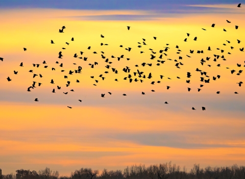
Since the Motus network launched in 2015, more than 30,000 birds, bats and butterflies have been tagged, but the majority of the 1,500 antennas are on land. Meanwhile, many species migrate over the ocean.
Extending the Motus network offshore can help managers identify migration paths as well as stopover habitat on land, where birds fuel up before long flights over open water. Conserving those areas is critical, as migration is the most perilous time in a bird’s life cycle, due to the physical demands.
Knowing more about where migratory species do and don’t go can also inform the design and placement of future wind farms to ensure they don’t interfere with these arduous journeys.
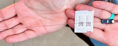
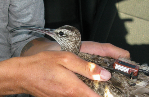
To gather more information about the flight paths of the red knot and piping plover, Dominion agreed to fund a two-year project in Virginia, tagging these species with Motus transmitters that weigh just a fraction of an ounce.
Biologist Katie Oliver at Chincoteague National Wildlife Refuge led the tagging effort for piping plovers, coordinating with other partners along Virginia’s coastal islands and Eastern Shore.
Larry Niles of the nonprofit Wildlife Restoration Partnerships led the effort to tag 15 red knots — seven at Monomoy National Wildlife Refuge on Cape Cod, and eight in New Jersey.
Just one year into the study, we’re starting to see results.
“We had two tagged piping plovers picked up by the receivers on the turbines, so we know these birds are out in that space,” Argo said.
High as a whimbrel
When the commercial-scale wind farm is built out, Dominion will install additional Motus stations, giving researchers more precise information about where tagged birds are in space, including how high they’re flying. A Motus transmitter doesn’t communicate a specific point — it gives off a radio wave signal, which is picked up by the antenna on a radio receiver. The more antennas you have in a given area, the better you can narrow down where that signal coming from.
The hope is that these birds are flying well above the turbines, and research on another migratory species indicates many of them are.
Dominion partnered with the Center for Conservation Biology at William and Mary College and The Nature Conservancy to fund a two-year tagging effort for whimbrels. Researchers used a different kind of tracking technology, solar-powered GPS tags, which use satellites to triangulate a signal and provide precise coordinates.
These tags have their limitations. For one, they’re too heavy for small-bodied birds like piping plovers to carry. One of the reasons researchers chose whimbrels for the study is they’re relatively big (about the size of a crow). They were also a strategic choice because other studies suggest they’re among the lowest-flying migrators — meaning they may be at greater risk for collisions.
But the study results show that, of the 30 tagged whimbrels, the majority maintained an altitude of 3,000 feet when flying near the turbines.
“There were a few that flew lower, but it’s mostly good news,” Overton said.
Setting the stage
The partnership between the Service and Dominion will carry over to the commercial site, where 176 800-foot-high turbines will produce 2.6 gigawatts of electricity, enough to power more than half a million homes each year.
“We will continue to work closely with the Service to monitor birds and bats,” Lawton said. “This is just the beginning.”
It’s also a preview of what’s to come. Offshore wind developers throughout the region plan to install systems like Motus as part of long-term monitoring in their lease areas, and the Service has worked with the Bureau of Ocean and Energy Management and other partners to set the stage for their success.
In collaboration with the Biodiversity Research Institute, the University of Rhode Island and Birds Canada (the developers of Motus), Loring led an effort to optimize and standardize the use of Motus at offshore wind farms by testing the technology at one of the first facilities to become operational in the U.S., Block Island Wind Farm.
The products of that effort, including a guidance document and an interactive study design tool, were released in 2023 and are available online.
“Now wind energy developers are starting to come to us for technical assistance,” Loring said.
The Biden administration has committed to approving 16 offshore wind farms by 2025, with the hopes that offshore wind energy will power 10 million homes by 2030.
To be prepared, the Service recently used funding from the Inflation Reduction Act to hire five renewable energy biologists. The new staff will provide technical support for these projects and assess the impacts of offshore wind energy on migratory birds.
"There’s still lots we don’t know,” Loring said. “With this added capacity, we can identify information gaps and start to address them through research studies with partners.”
Blowing in the wind
Additional offshore wind leases have already been proposed in the central Atlantic region, including one directly east of Dominion’s, creating the potential to ask more questions about migratory species. The answers may be blowing in the wind.
Written By
Published
Related Stories
Latest Stories